High-resolution aerial imagery from Nearmap empowers Yucaipa Valley employees with up-to-date 2D and 3D location data at the office or in the field. Original article byNearmap.
See the benefit of integrating Nearmap within multiple applications
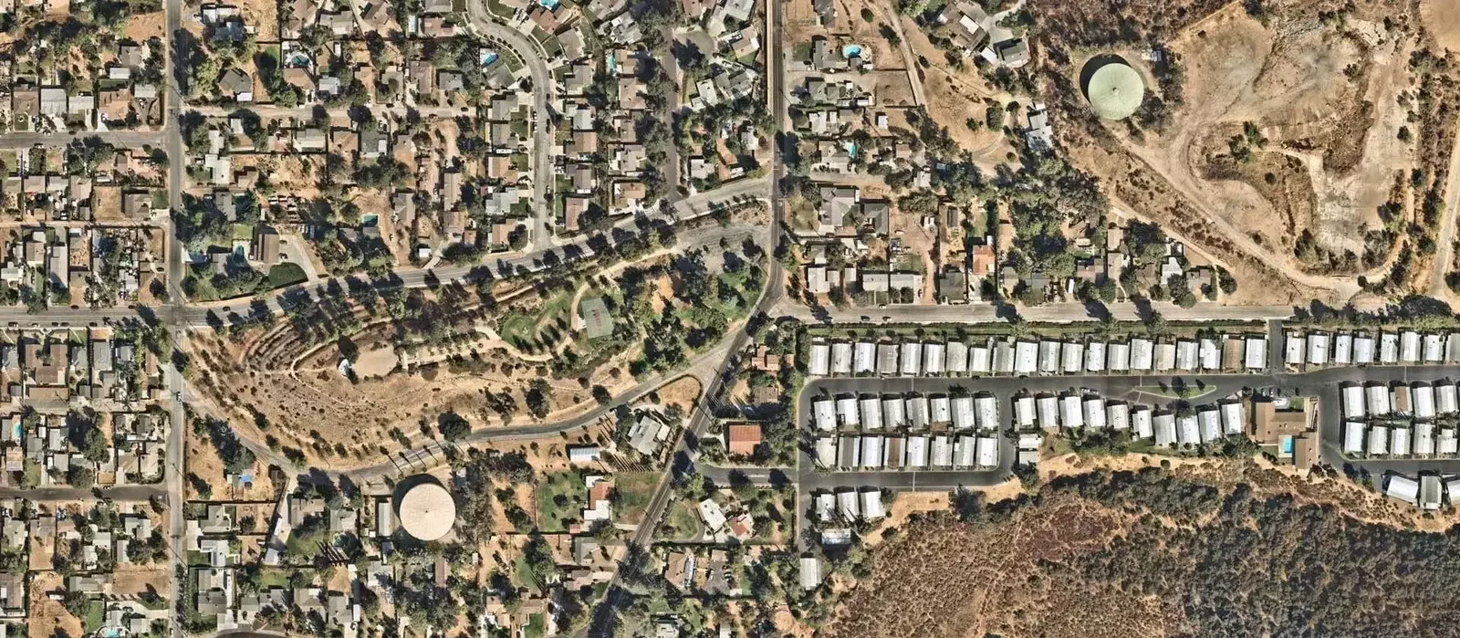
Nestled in the foothills below San Bernardino National Forest and the San Gorgonio Wilderness, Yucaipa Valley Water District (YVWD), located in Southern California, covers 40 square miles and has an elevation change of 3,140 feet. With hundreds of miles of drinking water pipelines, and over 13,000 water connections, the district uses multiple technologies to keep things moving.
Managing this scale of utilities has its challenges, and public agencies are seeking more efficient ways to manage their assets. With high-resolution aerial imagery from Nearmap, YVWD employees can access up-to-date 2D and 3D location content on many applications and devices, whether at the office or in the field.
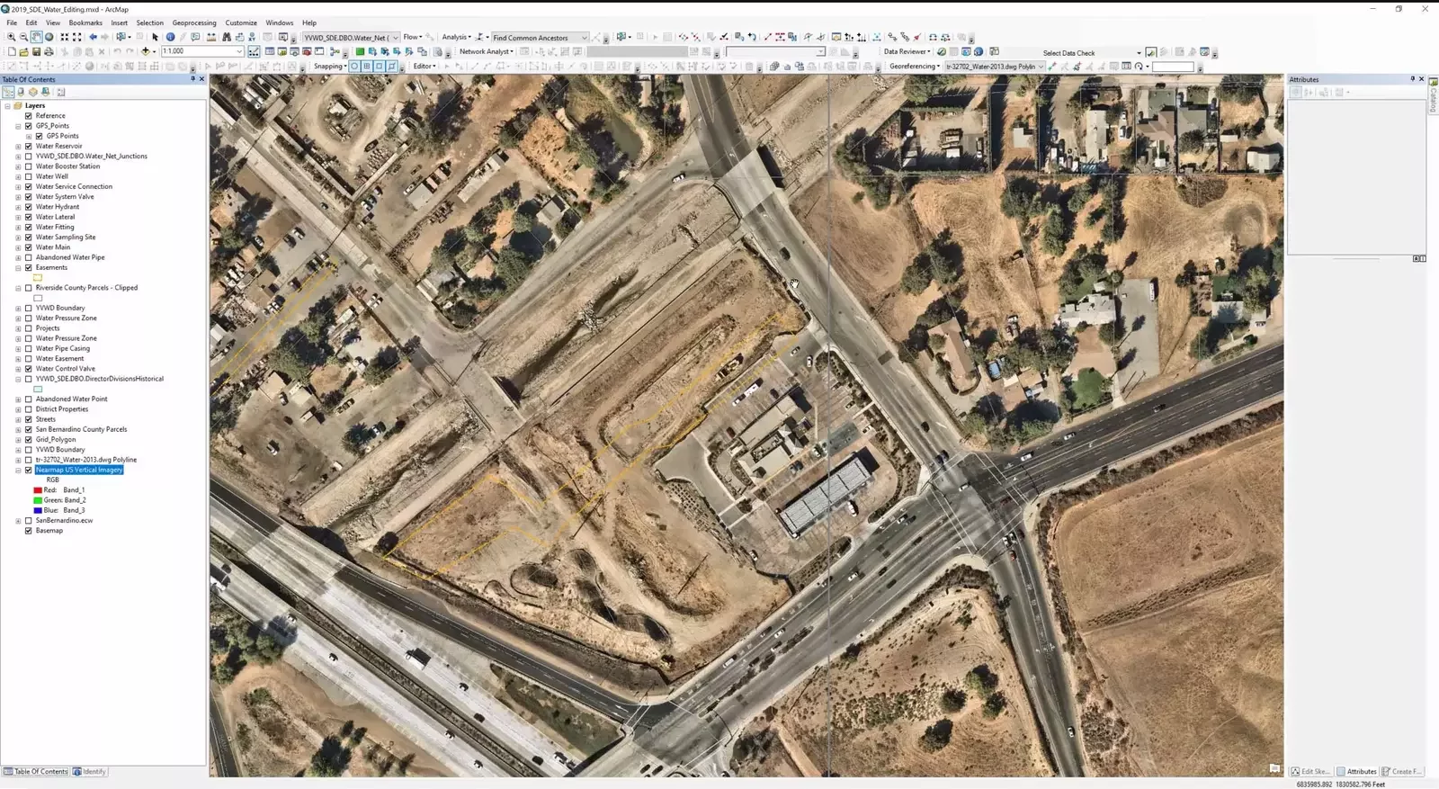
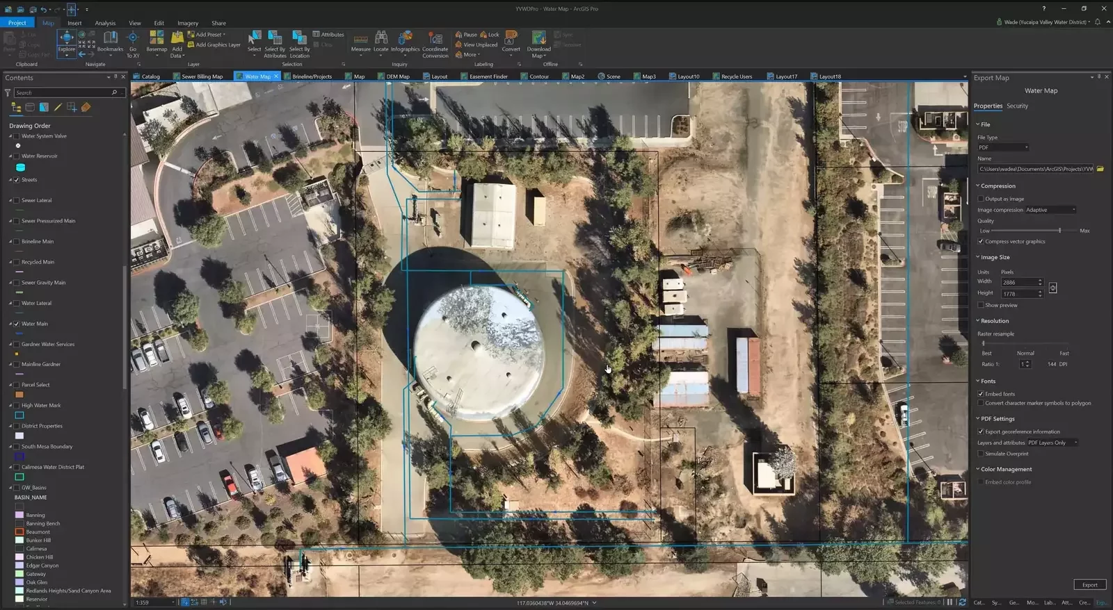
As GIS technology evolves over time, organizations value the ability to leverage Nearmap imagery across all of their applications. And, for Yucaipa Valley Water District, that includes Elements XS, ArcGIS Online, ArcGIS Pro, and ArcMap.
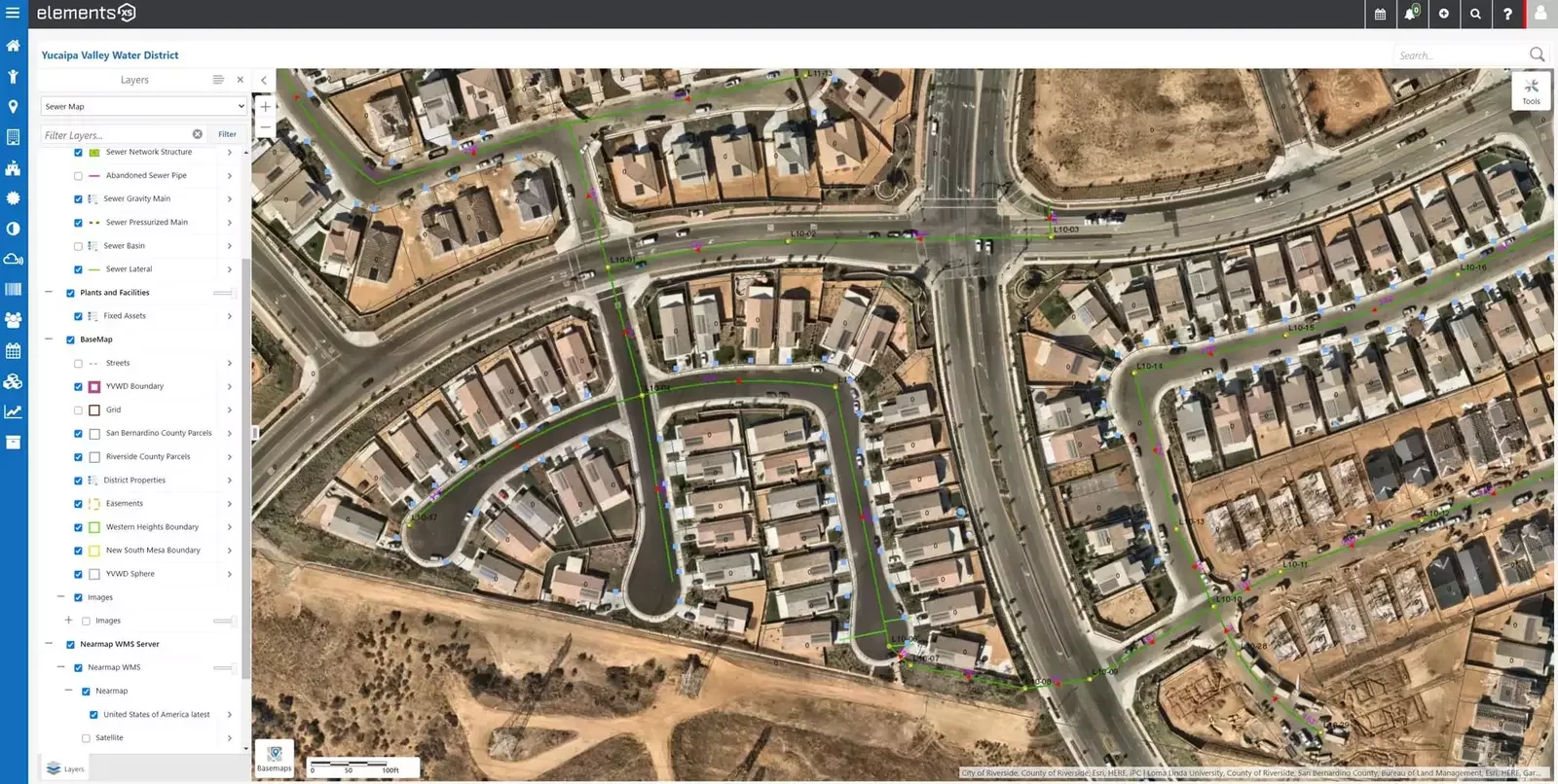
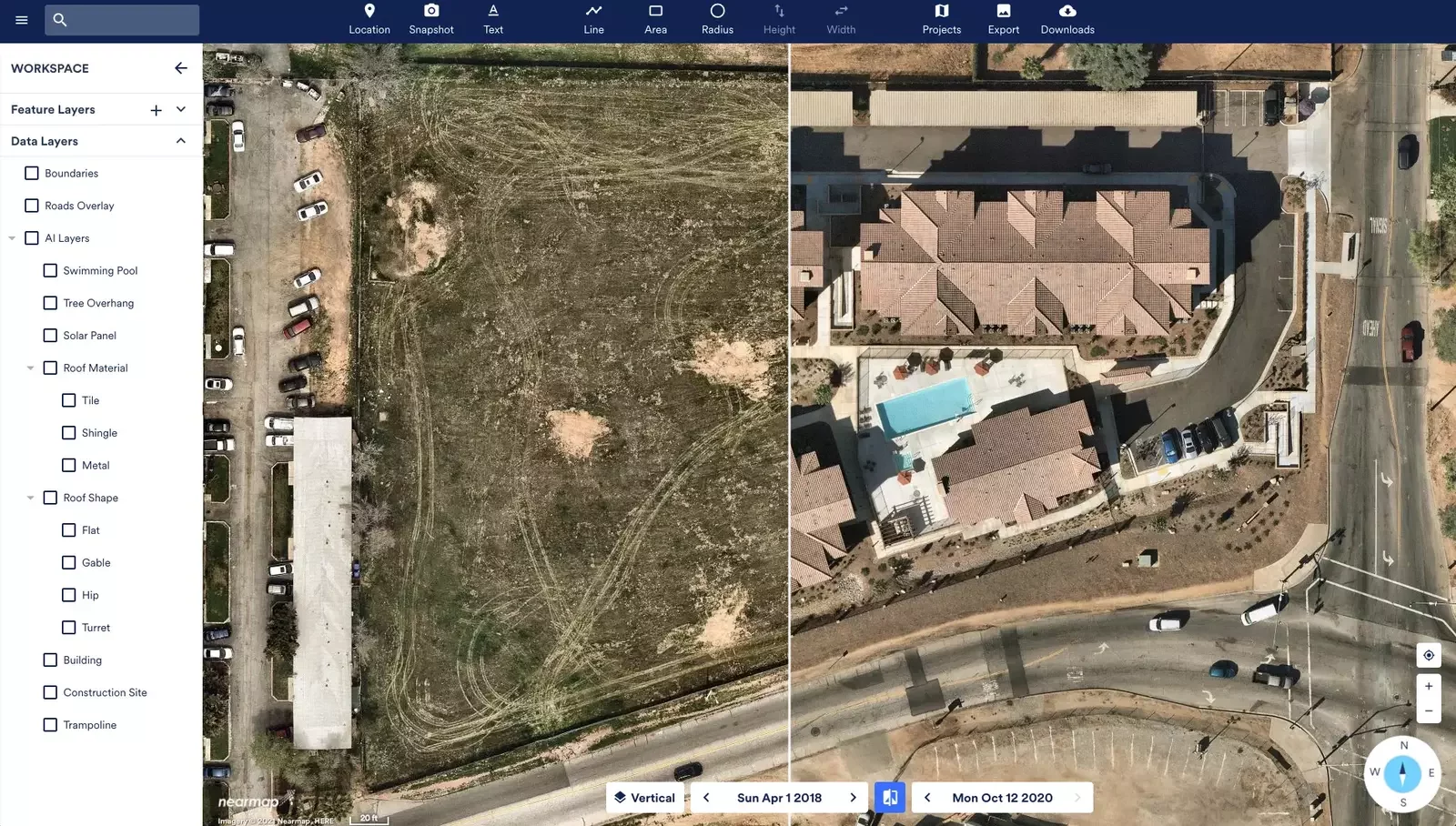
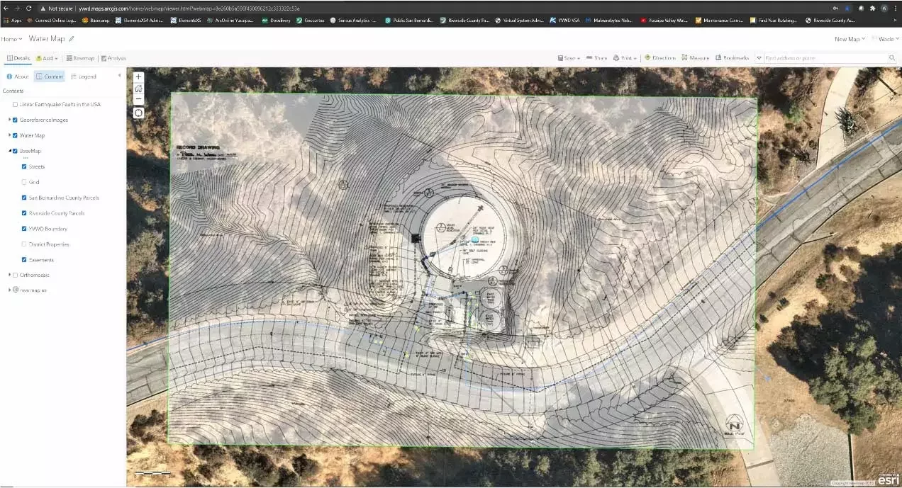
Often the district needs to view their AutoCAD drawings overlaid on Nearmap imagery to gather more specific information about a project or site. Rather than just simply viewing the drawing, the ability to lay Nearmap imagery below adds significant real-world context for the user. Below you can see an ArcGIS online map with Nearmap imagery included.
For asset management, Yucaipa Valley Water District uses Elements XS, an ArcGIS-based CMMS platform from Novotx, which utilizes partner integrations with VertiGIS Geocortex tools. Integrating Nearmap with this Elements was seamless and provided a natural fit for the organization’s needs. The district is uses Nearmap imagery in Elements XS to ensure data and mapping consistency across the organization. More importantly, it puts the most recent high-resolution imagery into the hands of those who need it so they can continue to manage assets with confidence.
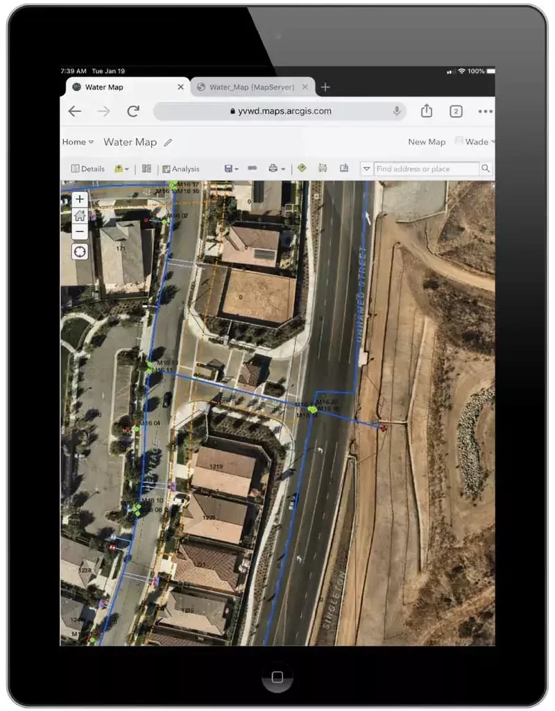
But it doesn’t stop there. Yucaipa Valley Water District has a large workforce of field crews, and using Nearmap imagery while in the field ensures that crews can correctly identify assets for work orders quickly as imagery with the latest changes are updated for all to see — minimizing room for error. With an elevation change of over 3,000 feet in the district, correctly identifying assets — like hydrants and their expected pressure — is important for ongoing maintenance of public utilities. Field crews are often on the move, and with their iPads, they can access the most current high-resolution imagery via ArcGIS Online or Elements equipping them with the latest data at their fingertips for asset management.
The ability to use Nearmap imagery across multiple applications is a key driver for gaining value in any imagery subscription. This ensures consistency in the type of content being viewed and minimizes the risk of misidentifying assets in the field. It also ensures consistency in communication as staff across all levels share a unified view of the world and stay informed of changes to operations, maintenance and project scope and requirements — simply by updating data layers.
For Yucaipa Valley Water District, Nearmap imagery is leveraged across ArcMap, ArcGIS Pro, ArcGIS Online, MapBrowser, and Elements XS through desktops, laptops, and iPads. That’s value and versatility that keeps the organization moving forward and transforming their workflows as they efficiently scale their maintenance and operations, remain flexible to change, and ensure a high-level of data quality.
Learn how you can leverage high-resolution imagery in ArcGIS, Elements or other technology systems at Nearmap.com.