
ENTERPRISE SOFTWARE FOR UTILITIES AND LOCAL GOVERNMENT
Citizen Requests
Simplified
…Because Your Inbox Deserves a Break
Connect with your community using a seamless, GIS-powered platform that keeps everyone in the loop.

Put Your Maps to Work
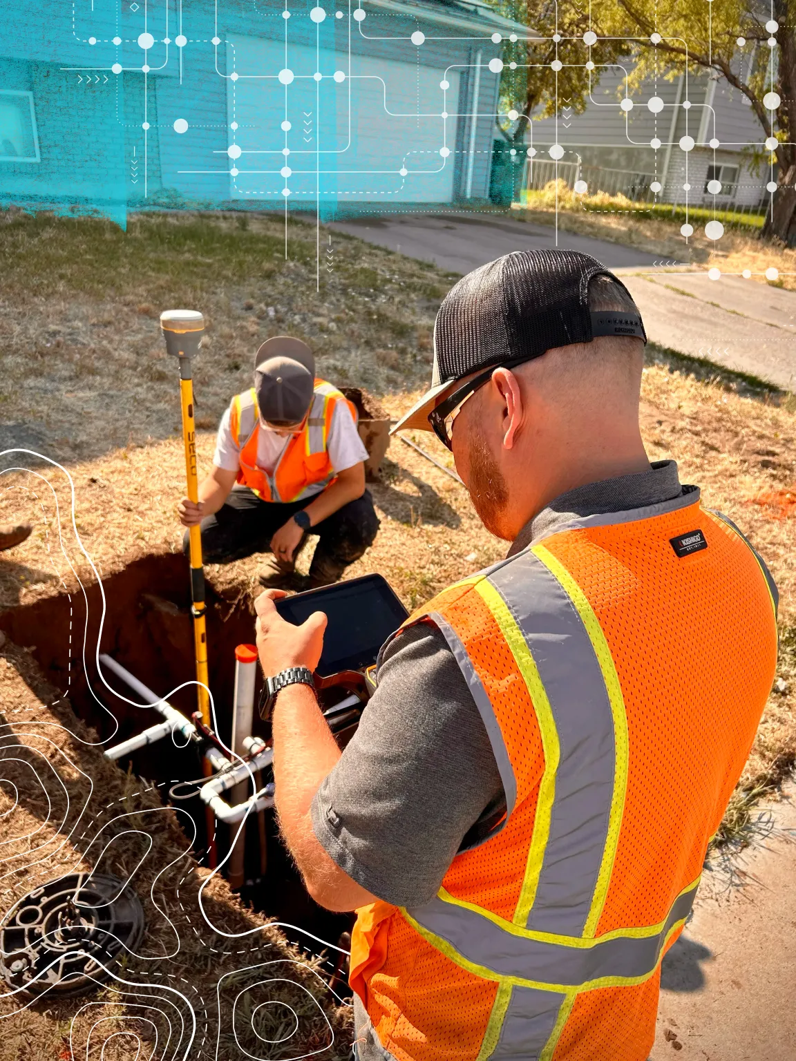
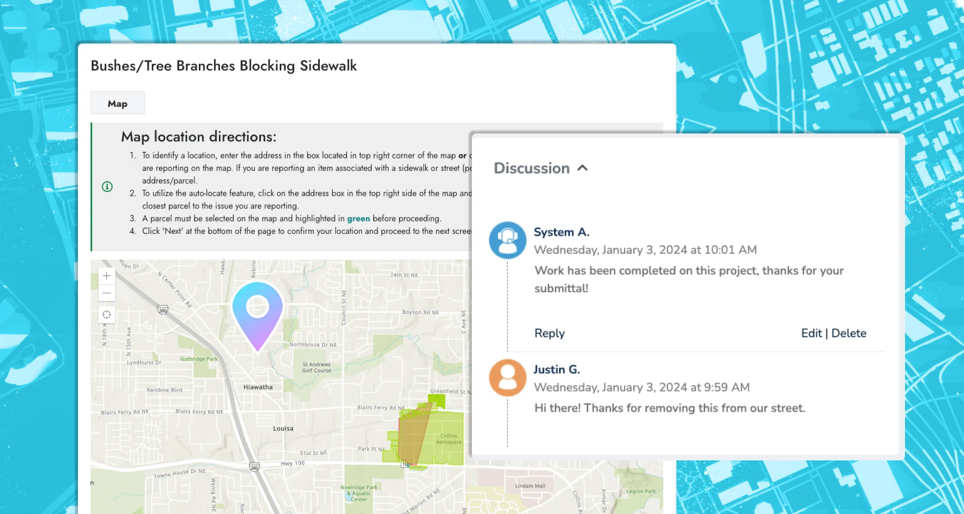
See exactly where issues are happening with location-based reporting and citizen-submitted photos. Use your existing ArcGIS maps for real-time, spatially-aware request management.

Ready When You Are
Hit the ground running with ready-to-use templates for the most common request types in utilities and local government. Easy to configure, easy to launch.

One System. Total Visibility.
Manage the entire request lifecycle in one centralized platform. From submission to resolution, everything lives in a single, integrated space—accessible to all departments.


Connect is more than a request form. It’s a fully integrated system that handles inbound requests across every department. From potholes to tree trimming, citizens can submit issues, track progress, and stay informed—all in one place.

Roads & Sidewalks
Transit

Trees & Vegetation

Trash

Finances

Construction

Parks & Urban Forestry

Permits

Licenses

Animal Control

Housing

Streets & Traffic
Features You’d Expect
Unexpected Innovation Throughout
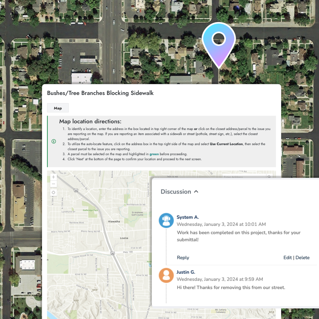
Spot the Issue
Capture the right details for every request type using custom forms and fields. Citizens can easily submit photos and other relevant info—all in one step.

Keep Them Informed
Use your own ArcGIS maps to show progress, share key updates, and highlight work in real-time. You decide what to display, keeping your community informed and confident.

Track It to the End
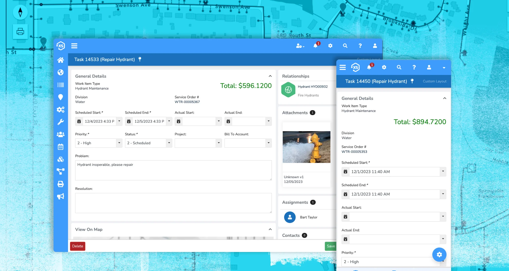
Track inspections, certificates, and resolutions in Elements XS. Automated notifications keep requestors updated from submission to closeout.

Time for Something Different
A platform that puts GIS front and center—and works seamlessly across your entire operation.
Why It Works
Built for the Whole Organization
Handle a wide range of inbound requests across departments—all from a single, integrated platform. Reduce software sprawl and streamline communication.
Seamless System Integration
Requests automatically flow into your asset management, permitting, and request workflows—no duplicate entry, no extra effort.
Powered by Esri ArcGIS
Enjoy a direct, real-time integration with Esri’s ArcGIS, putting your maps at the center of every process.
Unified Platform, Smarter Processes
Elements XS delivers a connected experience across your organization, combining asset management, permitting, and citizen requests in one place.
Customize Every Interaction
Create a seamless experience that reflects your agency’s brand and meets your unique needs.
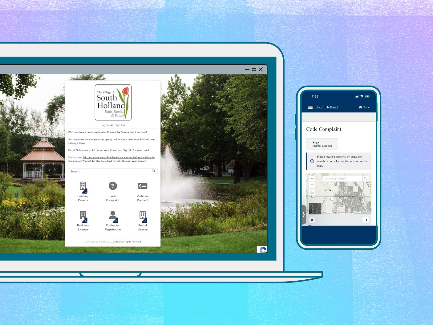
Branded Public Portal
Design your public-facing portal to reflect your identity—add your logo, colors, images, and more for a consistent, professional look.
Flexible Processes
Tailor data collection and business workflows for each request type, ensuring every process fits your agency’s specific requirements.
Make it Simple
Bringing clarity and ease to every step.
Effortless Request Submission
Report issues quickly by describing the problem, pinpointing the location on a map, and uploading photos. Users can create accounts to track progress and review past requests.

Stay Connected & Informed
Citizens can log in anytime to manage their requests. Automated alerts keep everyone in the loop, while direct ArcGIS integration makes sharing live public maps seamless.
Streamlined Management with Powerful Insights
From initial report to resolution—including costs and asset details—Connect with Elements XS streamlines your workflow. Create reports and dashboards combining request data with asset management and trending issue analysis to support smarter decisions.

Real-Time Maps & Location Awareness
Use your native ArcGIS web maps and apps directly in Connect to share up-to-date info. All requests tie to assets and locations, giving you a clear view of what’s happening where.
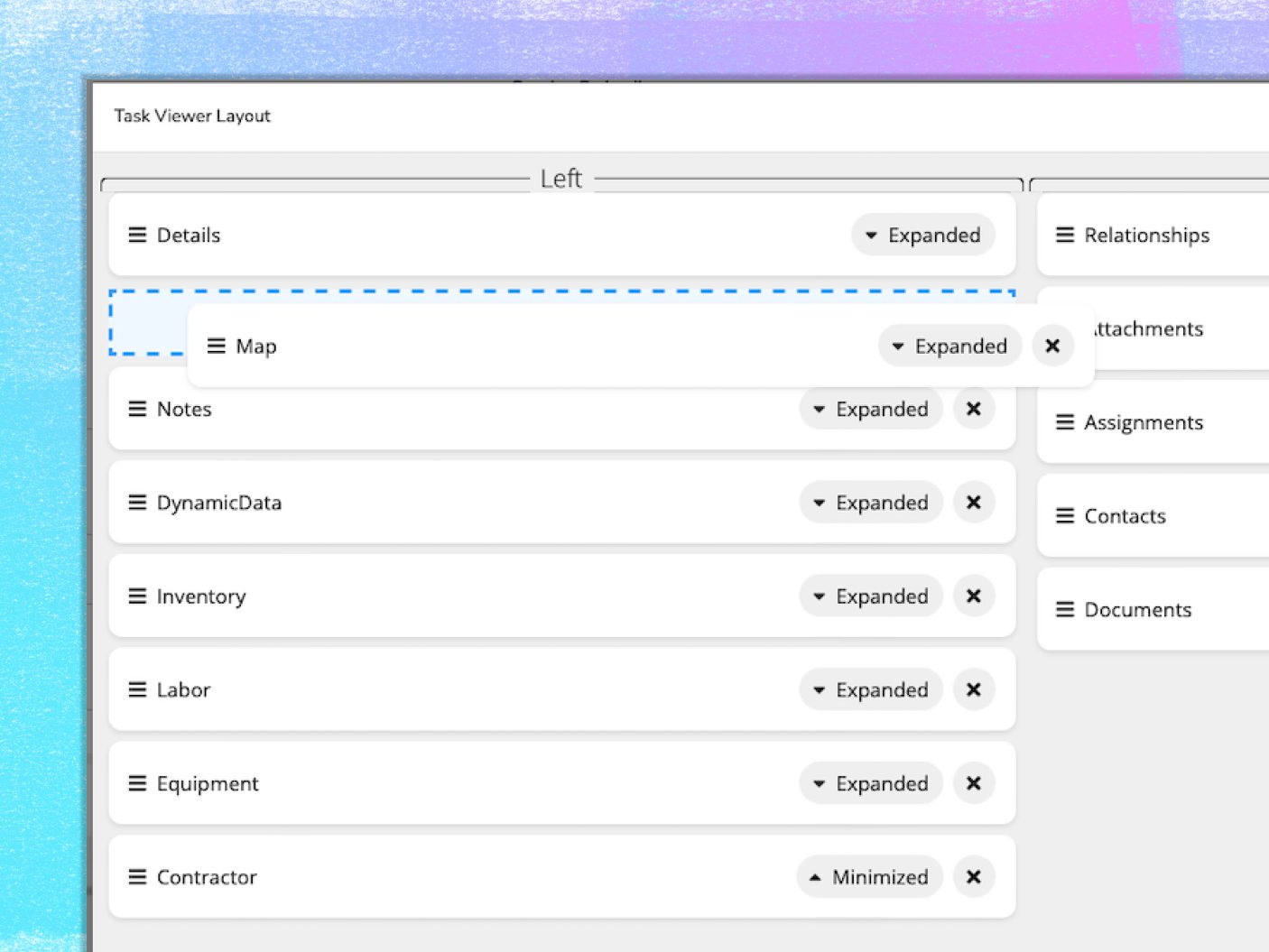
Create Your Perfect Setup
Tailor the interface with as many custom fields, forms, and automations as you need. From simple tweaks to full redesigns, it’s all in your hands.

Understand Your Citizens
Visualize citizen requests on your maps and generate insightful reports to make informed decisions.

Track Every Issue
Create unlimited request types, each tailored with unique data sets and automated workflows.

Capture Every Detail
Use custom fields and flexible form layouts to gather all the information needed for any request.

Streamline Dispatch
Automatically generate field work orders and assign tasks based on the data submitted.

Keep Everyone Informed
Set up email, text, and in-app notifications for almost any scenario to keep constituents up to date.

Mobile Ready
Citizens can access and manage requests from any device with an internet connection thanks to our mobile-friendly interface.

Elevate Your Citizen Experience
Turn citizen chaos into community calm with streamlined requests and clear communication.