
Report Violations
Citizens can login to your branded portal to submit concerns, nuisance calls, code violations, and other code-related items. nuisance calls, code violations, and other code-related items.

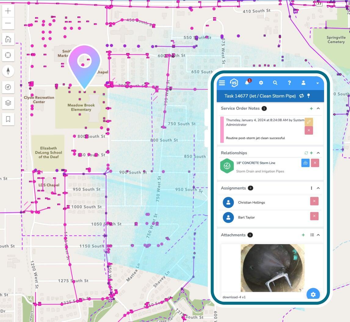
Track follow-ups
Configure automated follow-up tasks and rules to ensure violations are resolved appropriately.

Use your maps
See where violations are taking place and better understand trends using the direct integration to Esri's ArcGIS system.
How we stack up
This is not a one-trick code enforcement app, it's an enterprise platform used across all departments -
completely integrated with your GIS, asset management, citizen requests, permits, billing, and more.
Us
Them
Features you'd expect
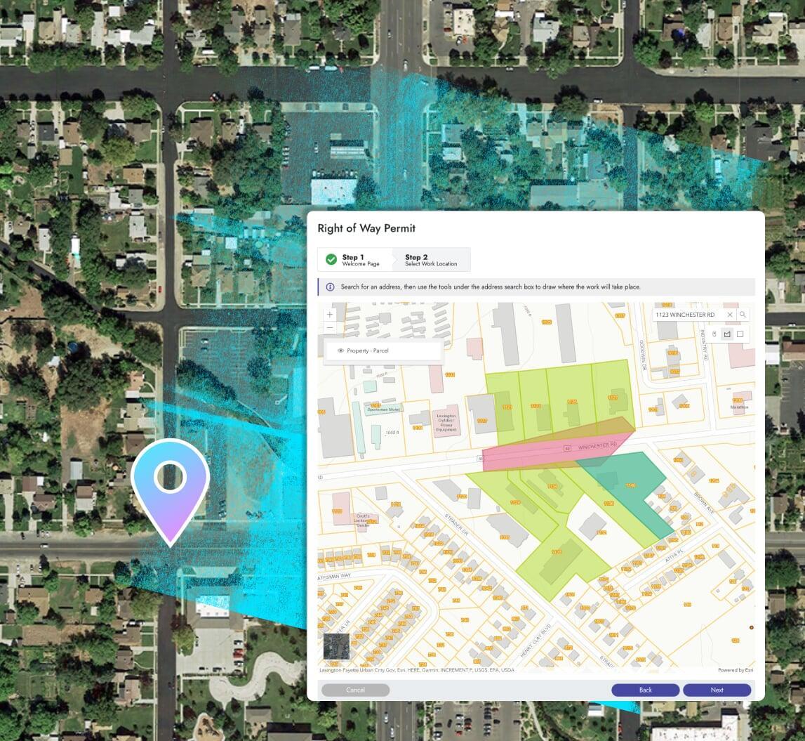
Branded online portal
Add your logo and custom branding to the online portal. Submit violations and incident reports online and perform field inspections onsite with your mobile device.

Fees + online payments
Manage fees and collect payments for unresolved or incorrectly resolved violations.
Inspections +
follow-ups
Streamline the process of creating and scheduling field inspections and reviews with user-definable automations.
Reports, dashboards, & analytics
Use the included designers to create new or modify pre-built reports in a snap. Leverage the seamless ArcGIS integration for map-based analytics.
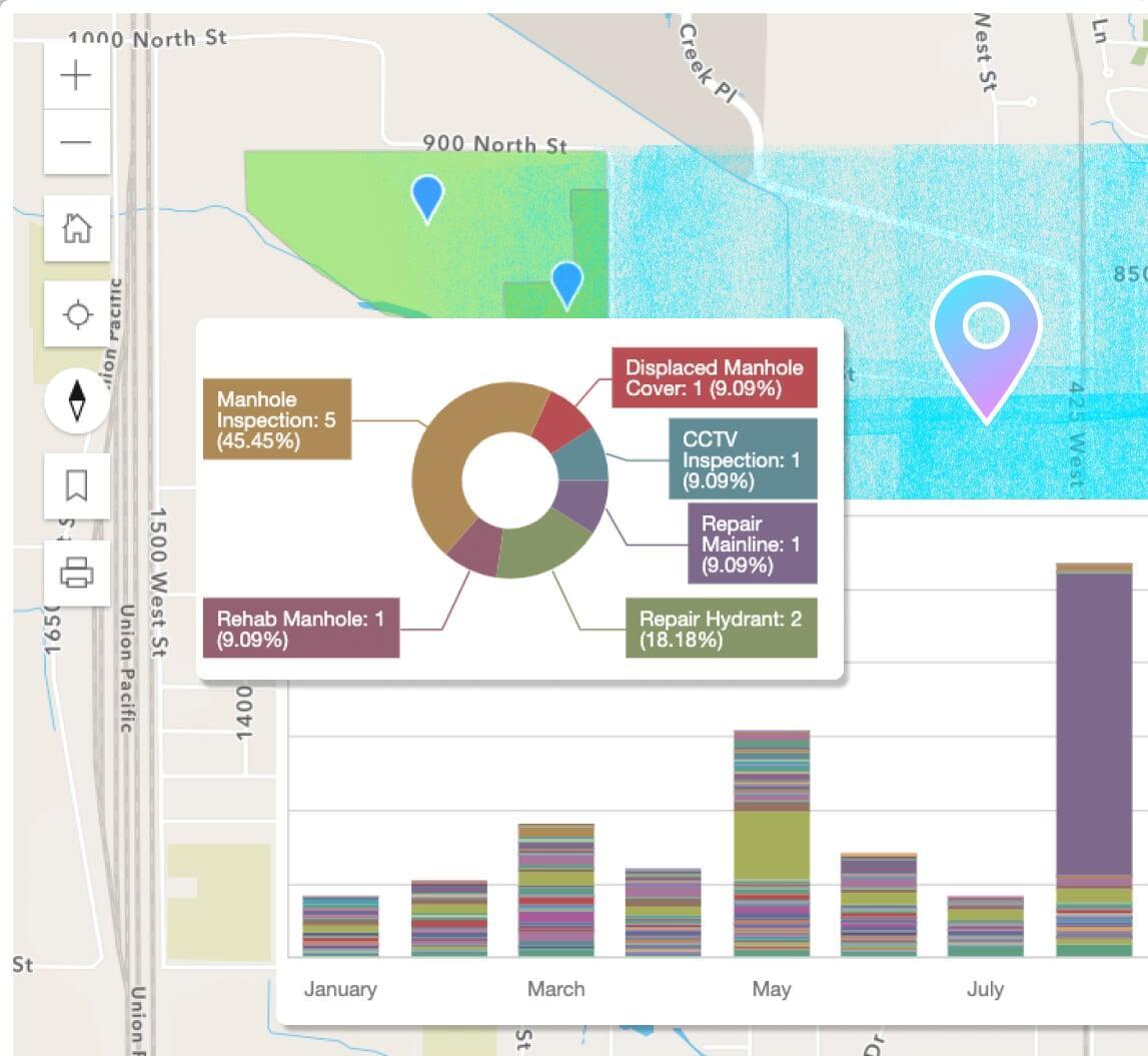
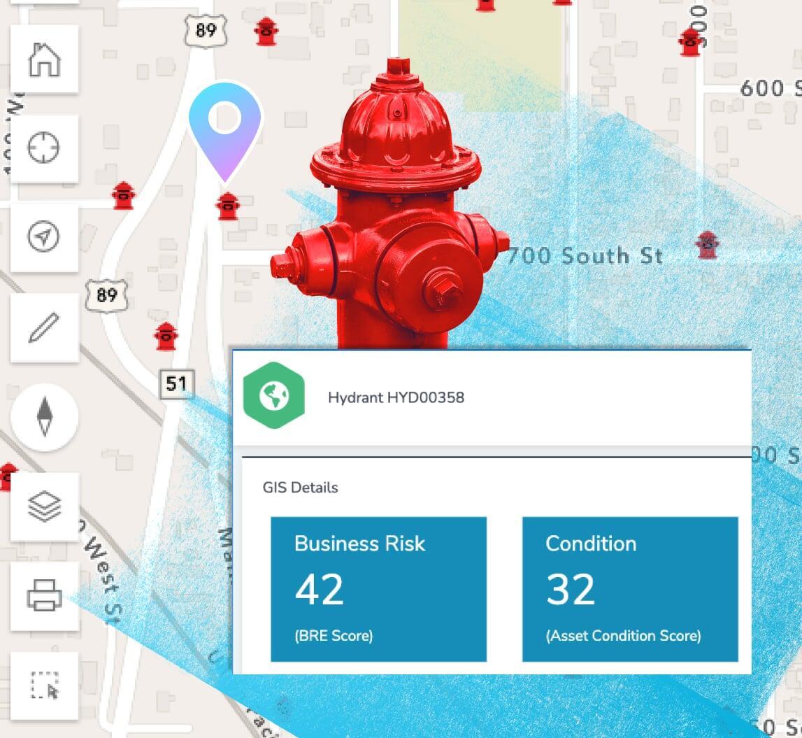
Maps + GIS
See where violations are being reported and where follow-ups are required. Gain insight to enforcement trends with the direct integration to Esri's ArcGIS system.
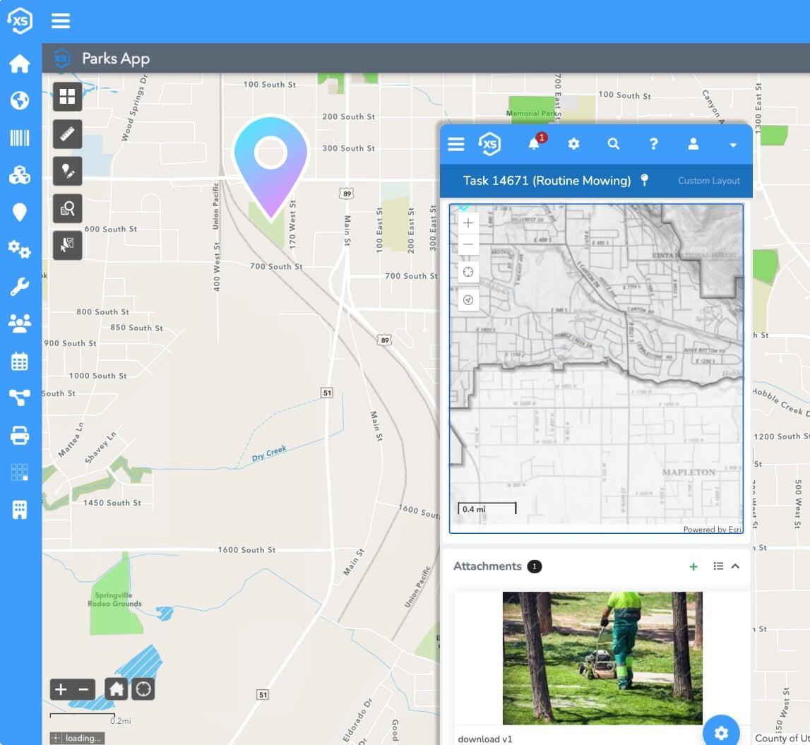
Mobile friendly
Report incidents, complete inspections and perform follow-up tasks in the field using any mobile device.
Create your ideal user experience
Easily tailor the interface with unlimited custom fields,
forms, and automations
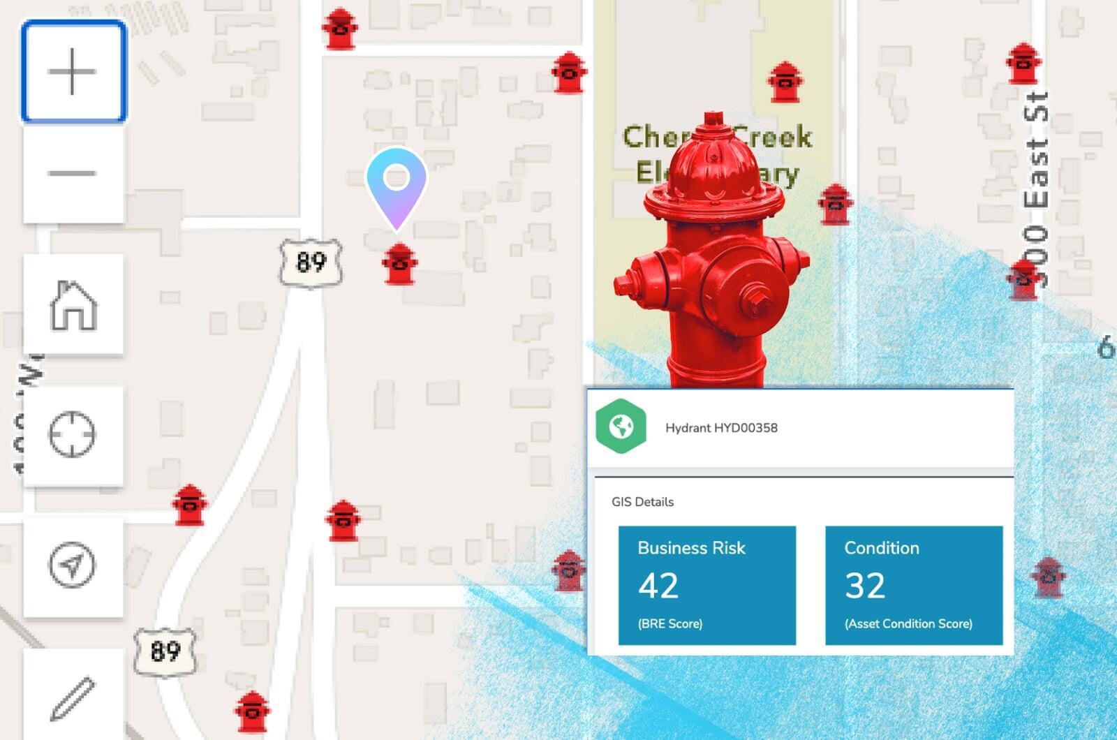
Leverage your maps
See where violations are reported, statuses, active case files, and so much more.
Direct, real-time ArcGIS integration
Your GIS acts as the singular, authoritative asset repository for all things spatial. Elements XS makes synchronizing or copying data to and from your GIS a thing of the past.
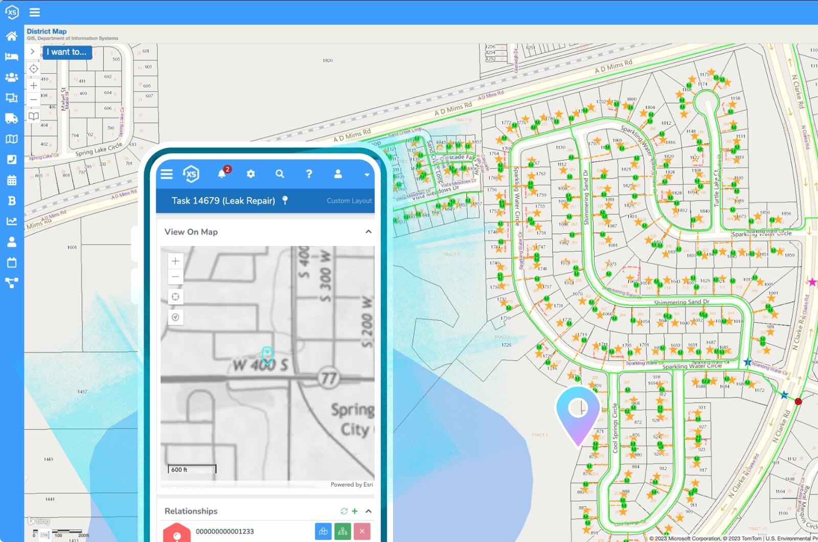
Share your maps
Use ArcGIS to create live public facing maps with real-time asset management, billing, and project information.