ENTERPRISE SOFTWARE FOR UTILITIES AND LOCAL GOVERNMENT
A powerhouse of flexibility for
Assets, requests, permits & more

Your main squeeze
Elements XS sits at the core of your operations, bringing everything together in a centralized interface for all groups to share information and coordinate efforts.

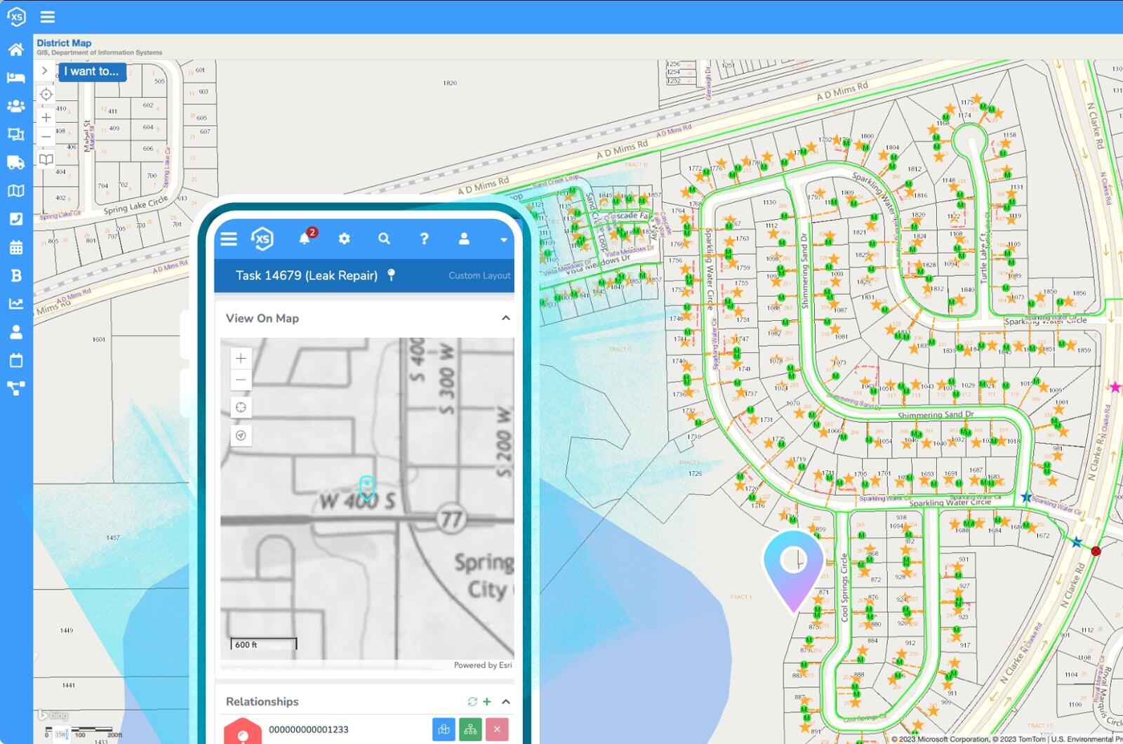
Maps everywhere
The best possible user experience starts here with the most flexible solution on the market, complete with user-definable automations, forms, datasets and more.

Your ideal UX
The best possible user experience starts here with the most flexible solution on the market, complete with user-definable automations, forms, datasets and more.
Nothing like it
Elements XS has been carefully crafted to balance extreme flexibility with simplicity, practicality,
and the best possible integration with Esri's ArcGIS system.
Us
Them
Loads of maps
Eliminate data duplication and GIS synchronization complications by directly accessing your ArcGIS system for a real-time connection, utilizing your GIS as the singular asset repository for all things spatial. Read More
Ultra-flexible, no custom code
Easily tailor menus, page layouts, data grids, and other interface components to reduce clutter and streamline data collection.
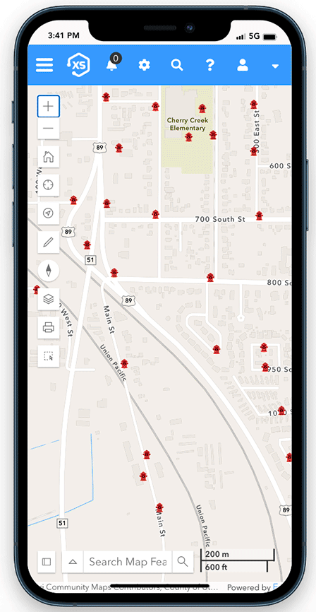
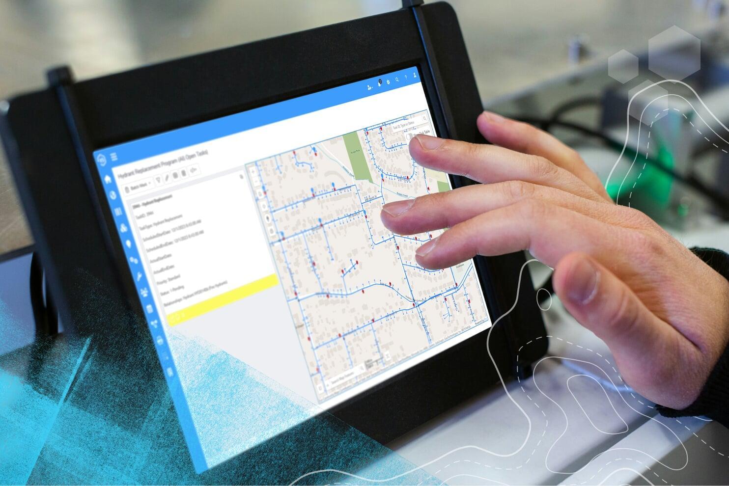
Mobile friendly
Access the app on any device from anywhere, online or offline.
Yes, it can do that
All the tools you need in a single, unified platform
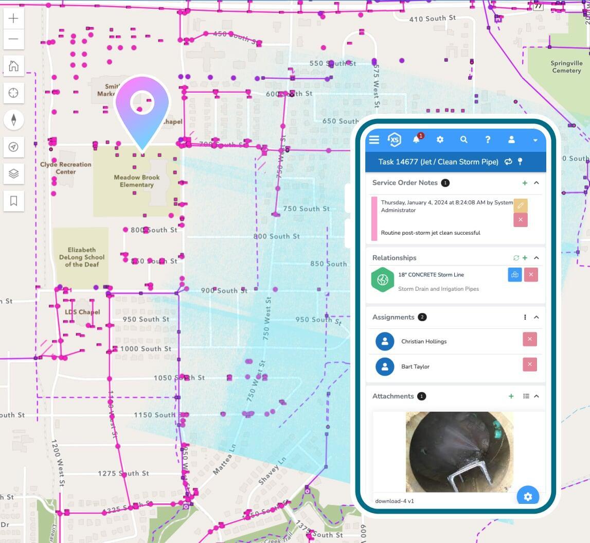
Asset Management
Track any type of work and all critical details for any asset or infrastructure. Work orders, maintenance, requests, costing, risk and so much more.

Citizen Requests
Manage inbound requests for downed trees, pot holes, and any other type of incident or request - easily keeping your citizens informed throughout the process.
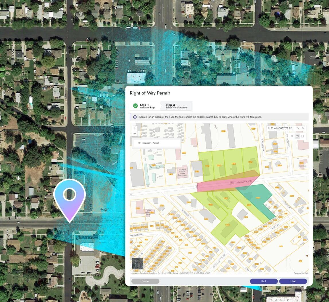
Permits & Online Applications
Process online applications, permits, and any other document using Elements XS.
Create your ideal user experience
Easily tailor the interface with unlimited custom fields,
forms, and automations
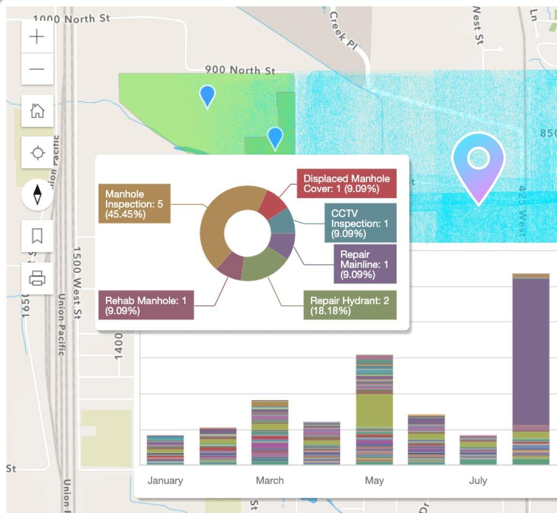
Reports, dashboards, & analytics
Use the included designs to create new or modify pre-built reports in a snap. Leverage the seamless ArcGIS integration for map-based analytics.
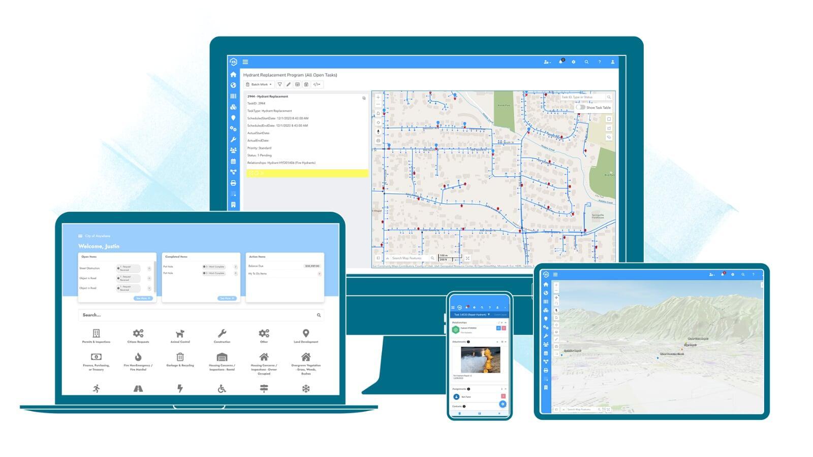
Adaptive, modern interface
Access the application anywhere, on any device with an internet connection. Take work offline using the native mobile apps.
Plays well with others
In addition to ArcGIS, Elements XS has been integrated with countless other technologies used by utilities and local government.
Don't worry be mappy
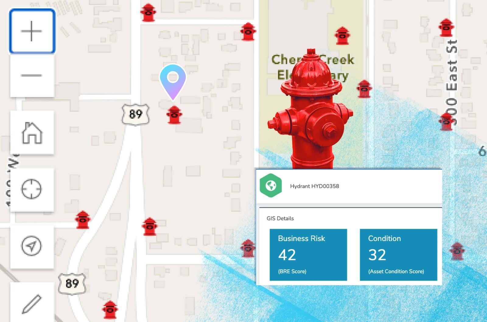
Ditch the data synchronization
Your GIS acts as the singular, authoritative asset repository for all things spatial. Elements XS makes synchronizing or copying data to and from your GIS a thing of the past.
Share your maps
Use ArcGIS to create live public facing maps with real-time asset management, billing, and project information.