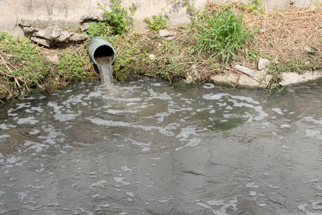
ASSET MANAGEMENT SOFTWARE FOR STORMWATER SYSTEMS
Stormwater Solutions That Don’t Rain on Your Parade
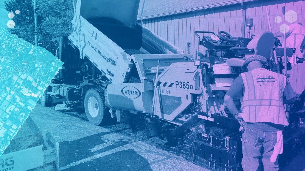
Efficient asset management to
keep you above water.

One System, Total Control
Catch runoff before it causes trouble. With real-time Esri integration, you can spot patterns, pinpoint problem areas, and make smarter, faster decisions—straight from the map.

Just one system
Inspections, work orders, requests, and reports—all in one place. No more bouncing between systems. Just one clean interface built for stormwater operations, from inlet to outfall.
All the tools
Track cleanings, inspections, and compliance with ease. Whether it’s a catch basin or a culvert, keep everything flowing with tools built to handle the mess.


Built to Fit. Not Pieced Together.
Plays nice because it was built to.
Our platform is a single, unified system built specifically for stormwater management. Every feature is crafted by one team with one mission: to simplify your operations and keep water moving smoothly through every part of your system.
Patchwork solutions can create gaps, delays, and confusion. With Novotx, all your tools work together seamlessly on one consistent platform—supporting everything from storm drains to detention basins—so you can manage your entire stormwater operation with confidence and ease.

One Platform to Rule the Workload
Handle assets, requests, inspections, and more without switching systems (or losing your mind).
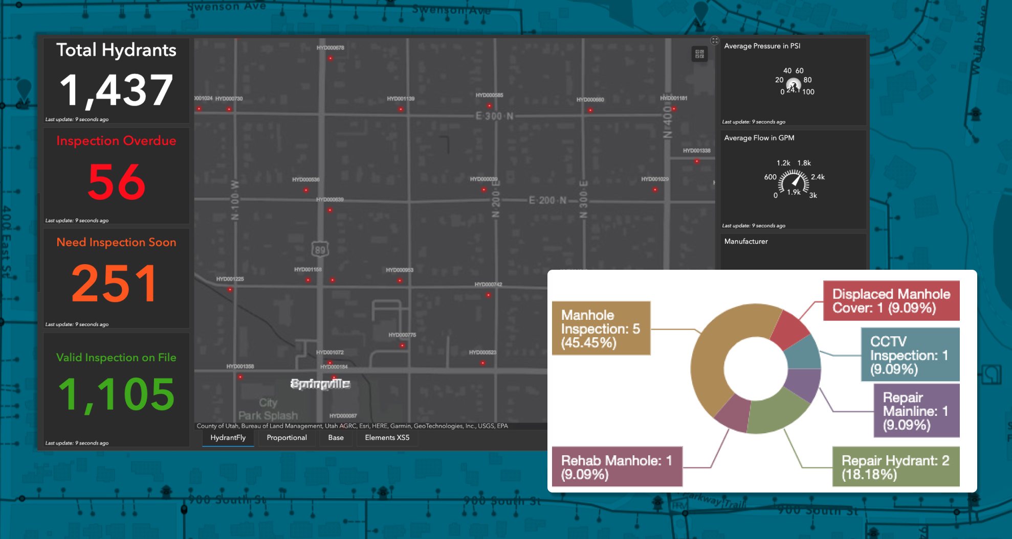
Monitor, maintain, and report—without drowning in spreadsheets. Novotx helps you stay on top of MS4 requirements, inspections, and maintenance so your team can focus on protecting the environment, not fighting the system.
Built for Stormwater, Inlet to Outlet
From collection lines to treatment plants—manage every part of your wastewater operation in one connected system. Asset management, permits, service requests, inspections, and more—all designed to keep your office efficient and your field crews flowing.
All-in-one

We’ve created the first unified platform that handles billing, asset management, and service requests—all in one place, with direct, real-time GIS integration for seamless workflows.
Built for Stormwater

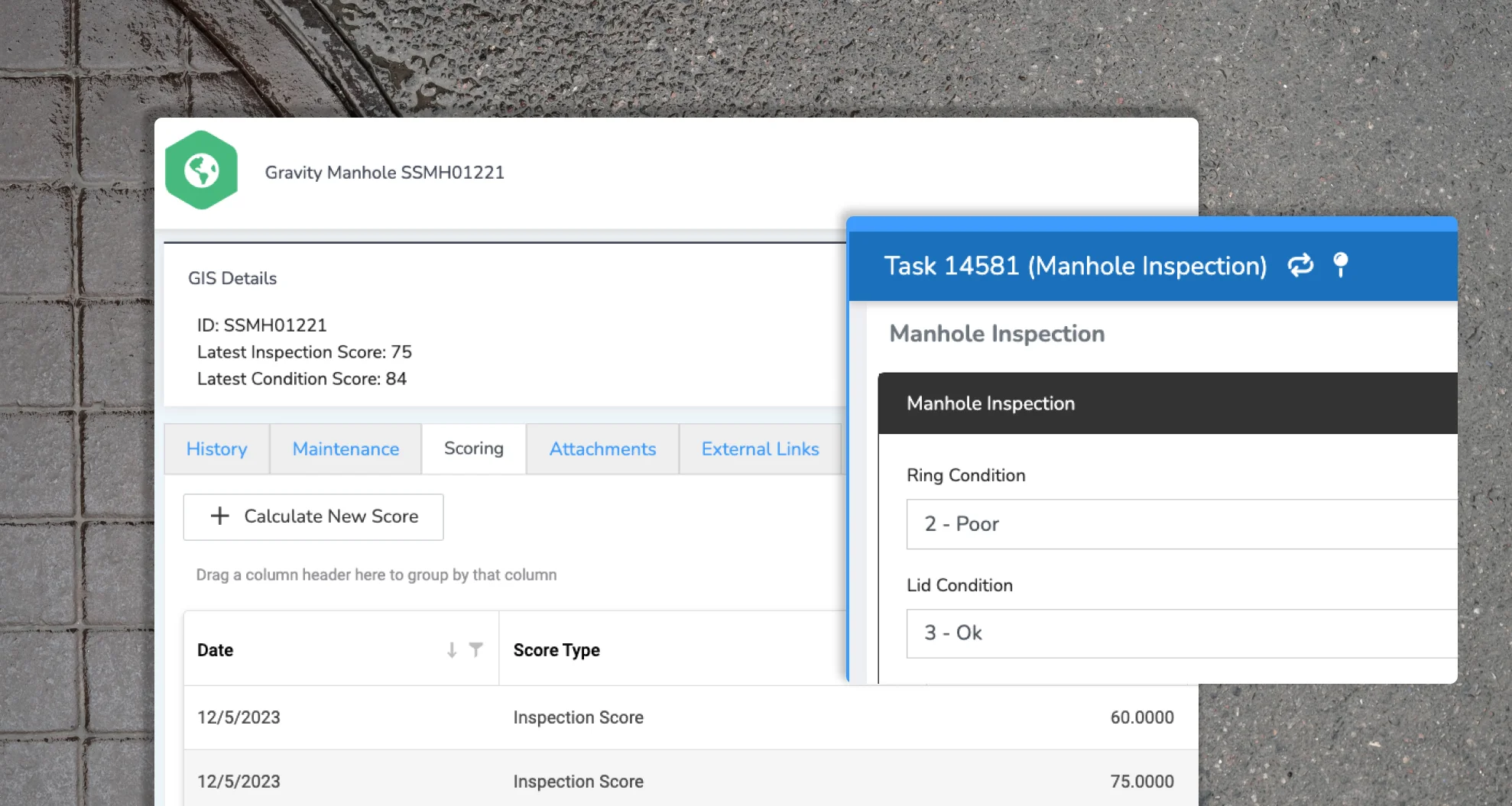
Get up and running fast with pre-built templates tailored for stormwater operations—complete with asset scoring and risk factors designed specifically for your needs. Plus, full support for Esri’s native water data models.
Work with Maps
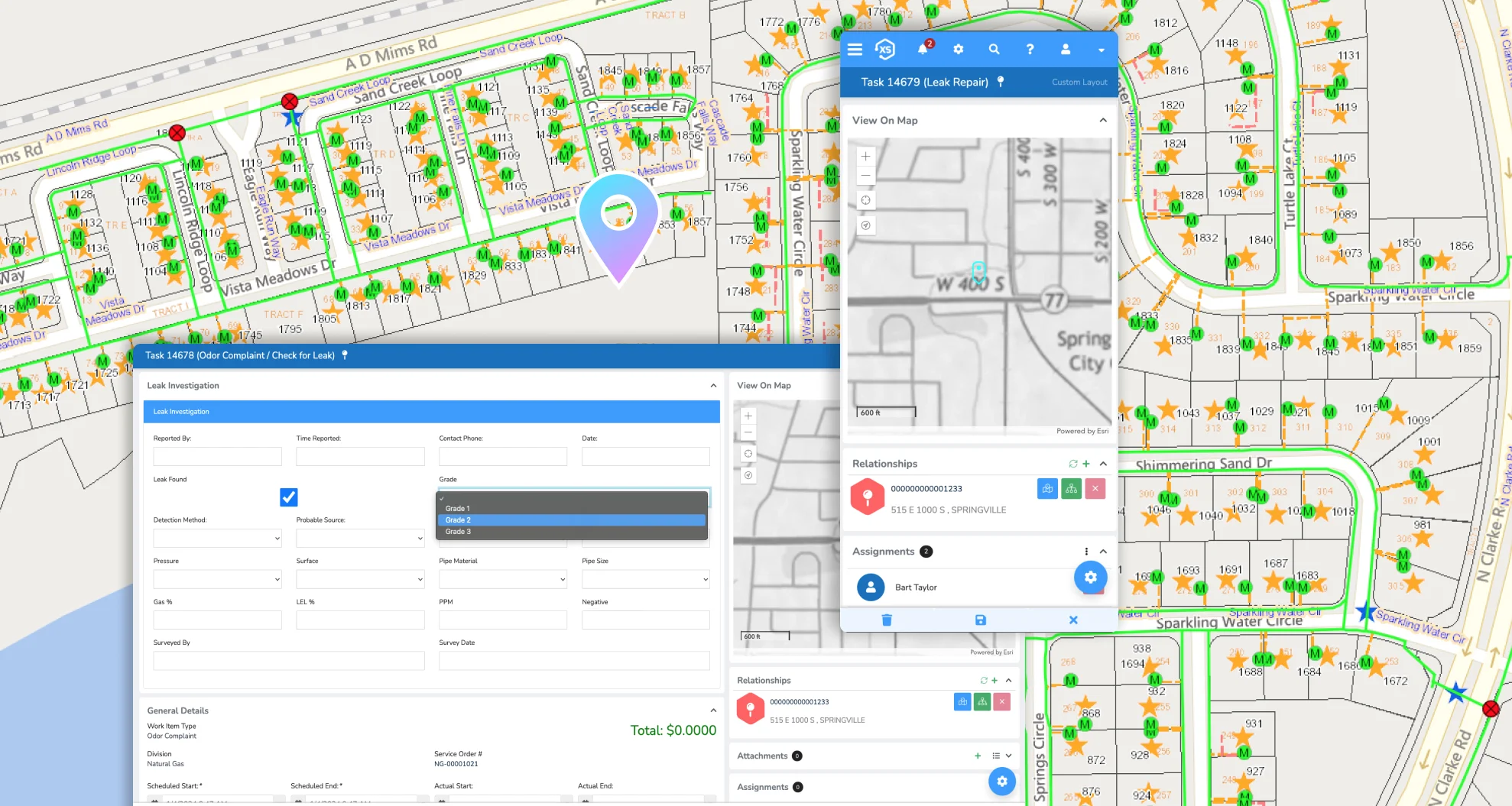
Experience the industry’s best Esri ArcGIS integration. Use your familiar web maps, apps, and more throughout the platform to get the most intuitive, map-driven user experience possible.
Maps Made Simple
Elements XS delivers the best integration with Esri’s ArcGIS platform, letting you work seamlessly with your native web maps, apps, and spatial data—right where you need it.

Keep it Connected
Your GIS is the ultimate authority for all spatial assets. Elements XS eliminates the hassle of syncing or duplicating data, keeping your stormwater asset information accurate and up to date.
Don’t Just Fix It, Forecast It
Turn real-time data into action with custom dashboards, reports, and map-based analytics. Monitor system health, prioritize critical infrastructure, and plan preventive maintenance using flexible metrics and business risk scoring—so you stay ahead of problems before they start.
Create Your Perfect Setup
Tailor the interface with as many custom fields, forms, and automations as you need. From simple tweaks to full redesigns, it’s all in your hands.

Make It Yours
Customize your interface with unlimited fields, forms, and automations built specifically for stormwater management.

Set It and Forget It
Create endless automations to handle follow-ups, work assignments, notifications, and more to keep projects moving.

Put it on the Map
Use ArcGIS integration to update multiple assets at once, adding labor, materials, and equipment costs in a single step.

Ping the Right People
Set up notifications for any scenario so your whole team stays connected and up to date, no matter where they are.

Custom without the Chaos
Build unlimited custom forms, layouts, lists, and automations tailored to your unique stormwater workflows.

Anytime, Anywhere
Access all your data and tools on any device, online or offline, so work never has to stop.
Mitigate Risk
Track every record with ease and maintain a digital history to monitor how your stormwater assets and land evolve over time. Use smart scoring tools to keep a close watch on critical infrastructure and prioritize what needs attention.
Get Your Workflow-ing Smoothly
Dive into better stormwater management,
no more sinking in paperwork.