
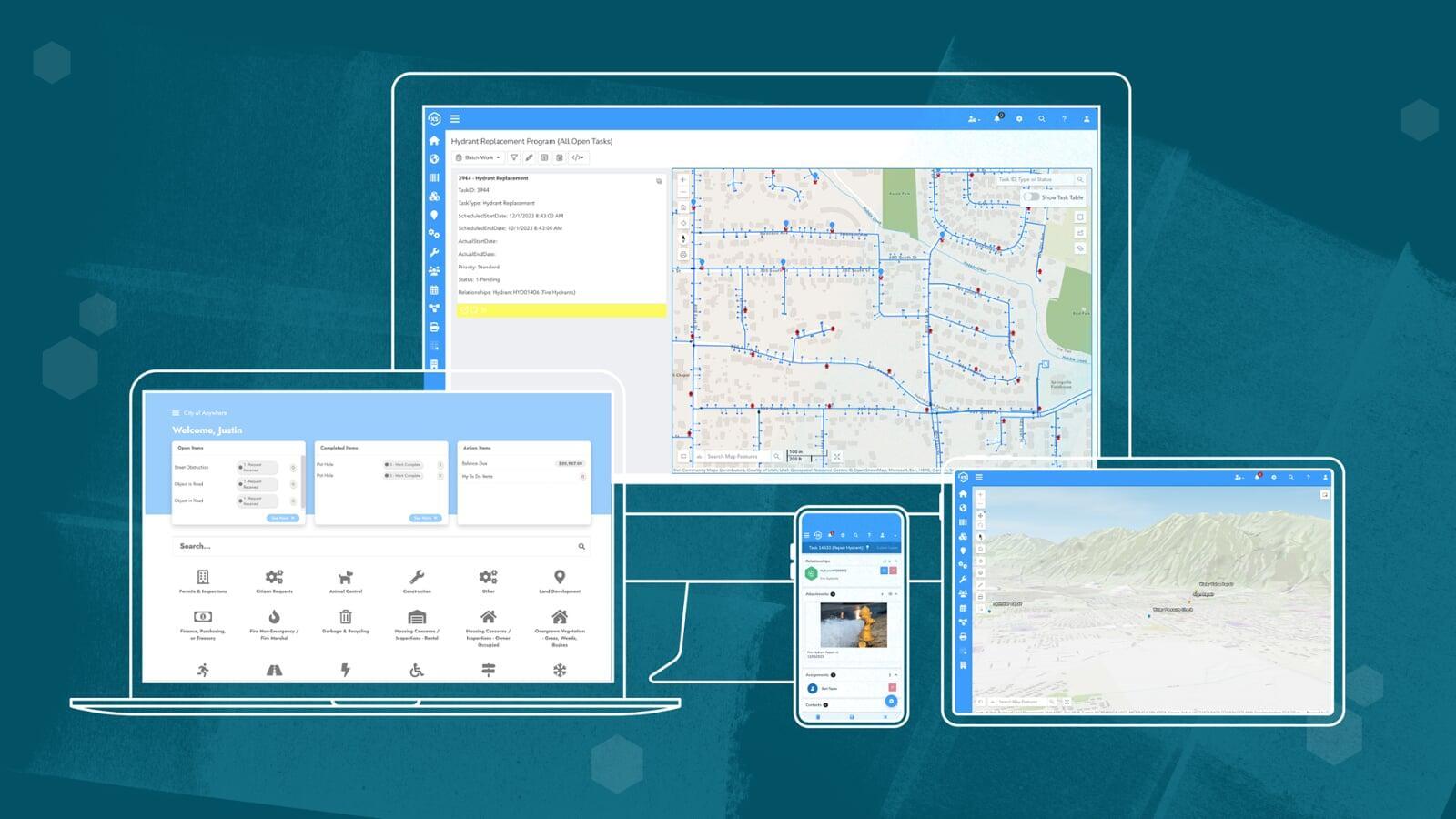
Maps everywhere
A direct integration with Esri's modern ArcGIS platform maximizes your GIS investment. See where your trees are and where attention is needed to keep all of your assets in top-shape.

Experience the dream
Easy to learn, easy to use. Spend more time helping those trees produce oxygen and less time learning how to use the software thanks to our ultra-flexible, modern interface.learning how to use the software thanks to our ultra-flexible, modern interface.

Just one system
One interface to manage all of your forestry-related activities. Everything from inspections to trimming, routine maintenance, work orders, treatments, and more.activities. Everything from inspections to trimming, routine maintenance, work orders, treatments, and more.
Forestry groups everywhere trust our platform for inspections, asset management, requests, treatments, and much more.
What's the difference?
Us
Them
Asset & work management
Routine trimming + treatments
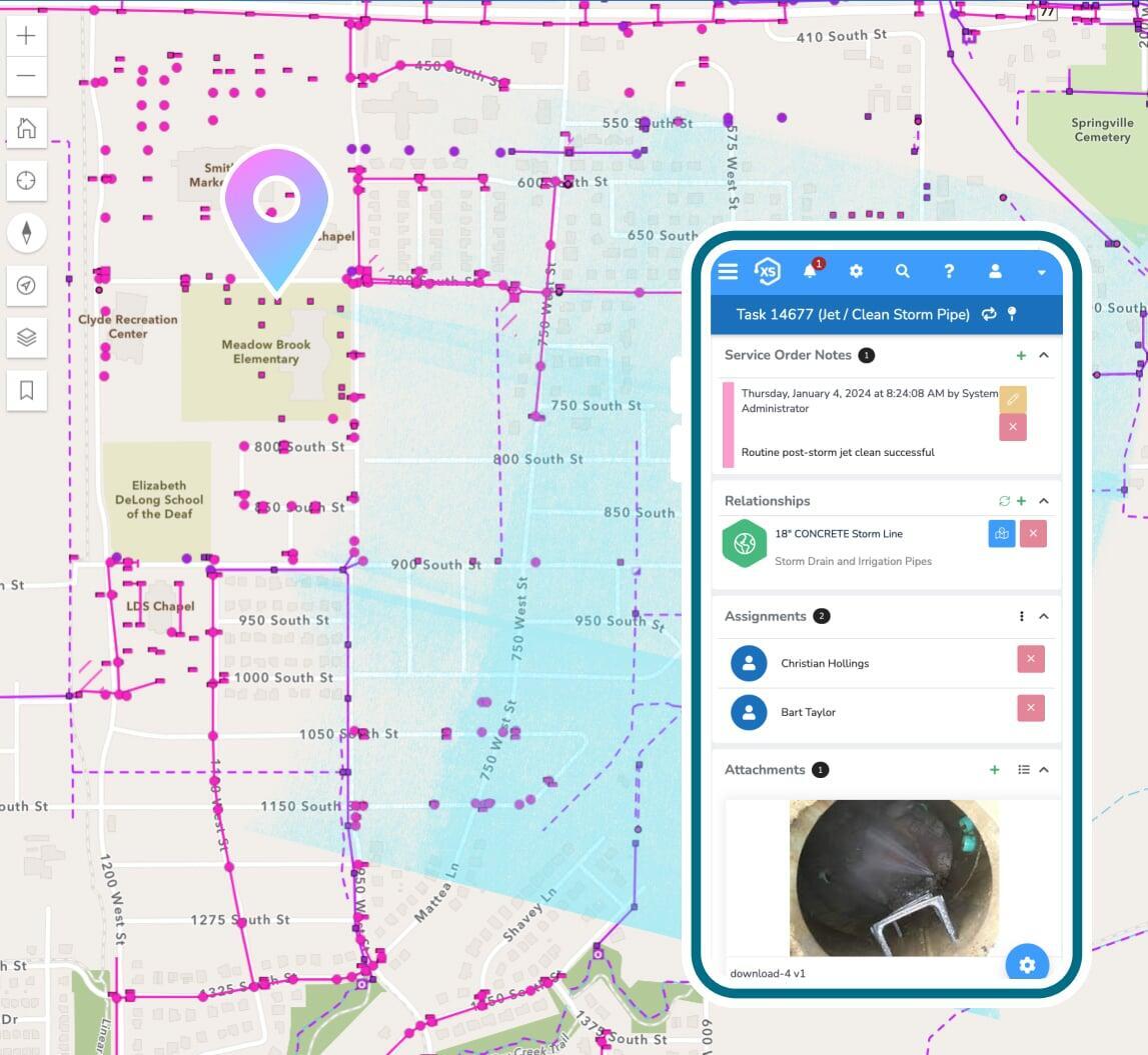
Automate routine trimmings, treatments, and other activities for all trees and assets. Process inbound requests with a custom branded portal and create work orders to track labor, materials, and equipment costing information for work performed. Keep your citizens informed as work is completed and measure performance against service level commitments.
Hazards and code violations
Manage notices and compliance for trees or assets that have not been kept to code or are interfering with public safety. Trigger automated follow-up events to ensure proper resolutions, keeping your constituents informed along the way.
Make The Lorax proud
Keep your trees in top-shape with modern, flexible software.
Work from anywhere
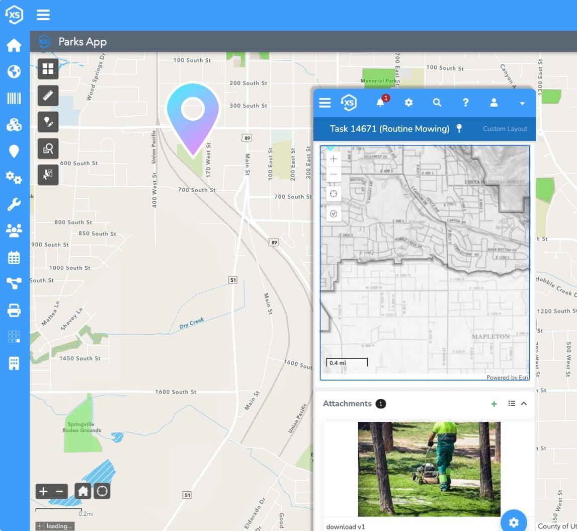
Get things done using any device, anywhere with our modern adaptive interfaces. Native apps for iOS and Android take data offline ...and bring it back when you're ready.

Manage inspections
Create inspection forms to fit your specific needs for all types of trees using unlimited custom fields and custom form layouts. Auto-generate treatment follow-ups based on inspection results.
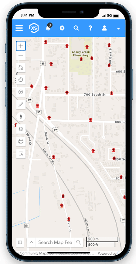
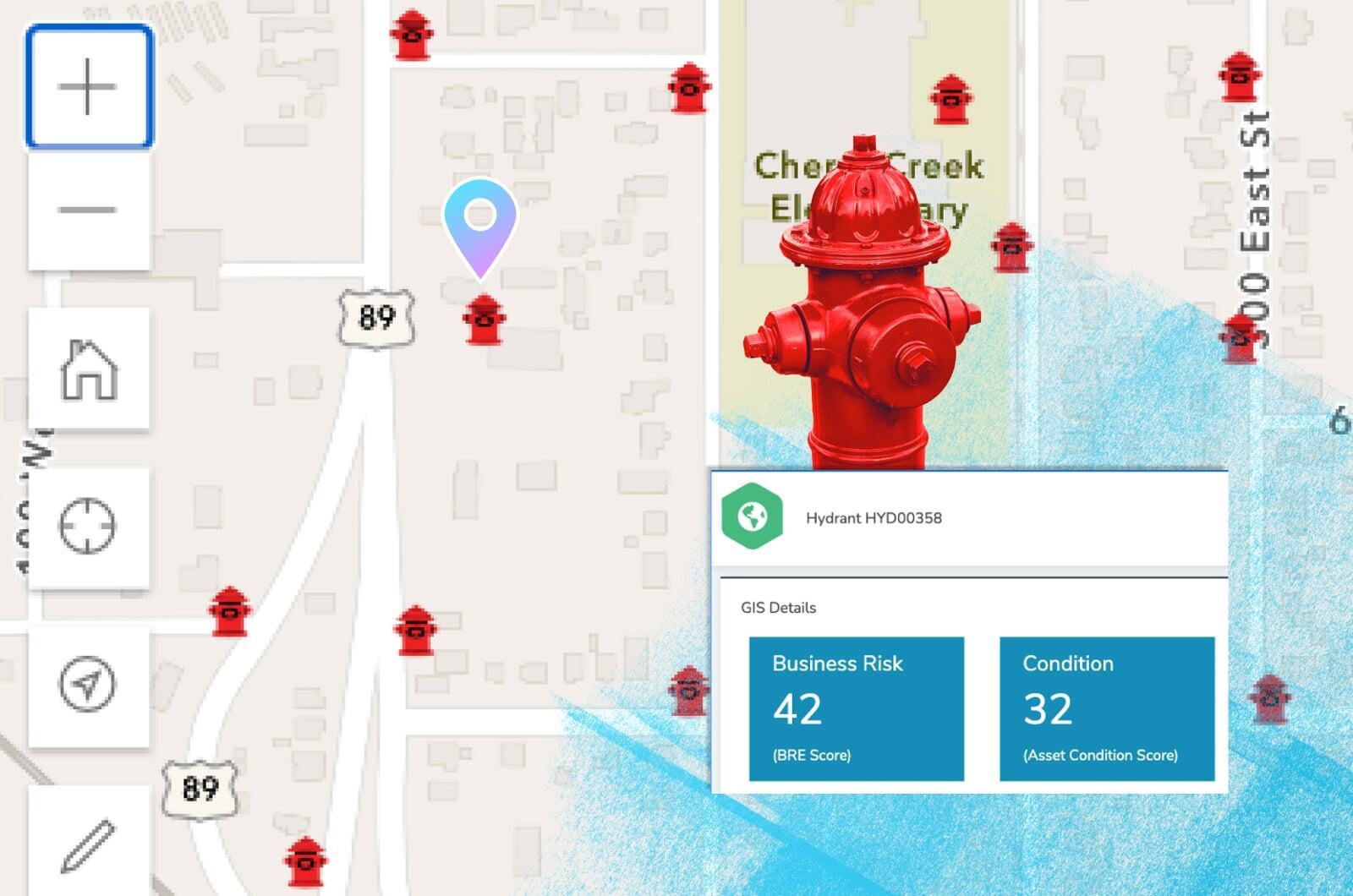
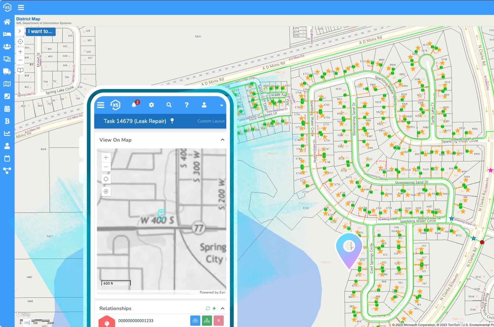
Use your maps
The best integration with Esri's ArcGIS system you'll find, period. Use your native web maps, apps, and more throughout the platform to easily see where diseased trees are located, where work needs to take place, and much more for better-informed decision making.
Reports, dashboards, & analytics
Use the included designs to create new or modify pre-built reports in a snap. Leverage the seamless ArcGIS integration for map-based analytics.
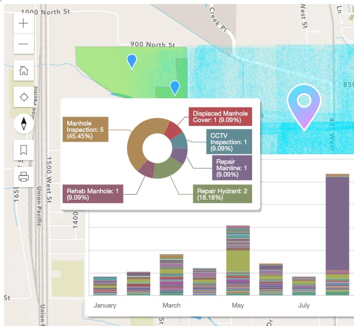
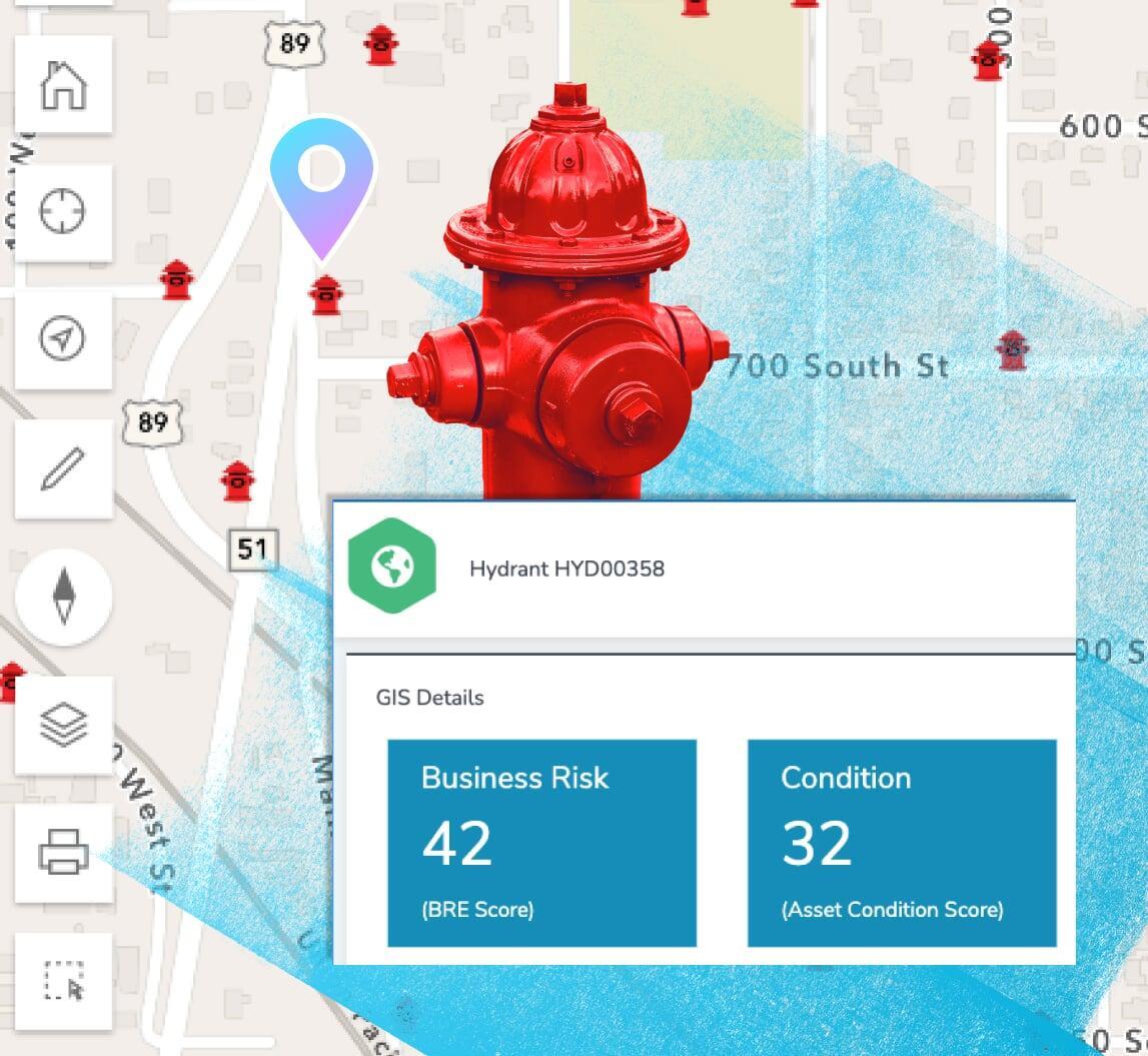
Business risk & asset scoring
Prioritize critical infrastructure with scoring and risk management factors including probability of failure, consequence of failure, and more.
Maintenance: preventive & routine
Schedule maintenance based off of calendar dates, completed maintenance tasks, mileage, runtime hours, and other user-definable metrics.
Moving forward
Find critical trees
+ prioritize work
Put your energy into a data-driven,
non-subjective work queues.
Create your ideal user experience
Easily tailor the interface with unlimited custom fields,
forms, and automations
Don't worry be mappy
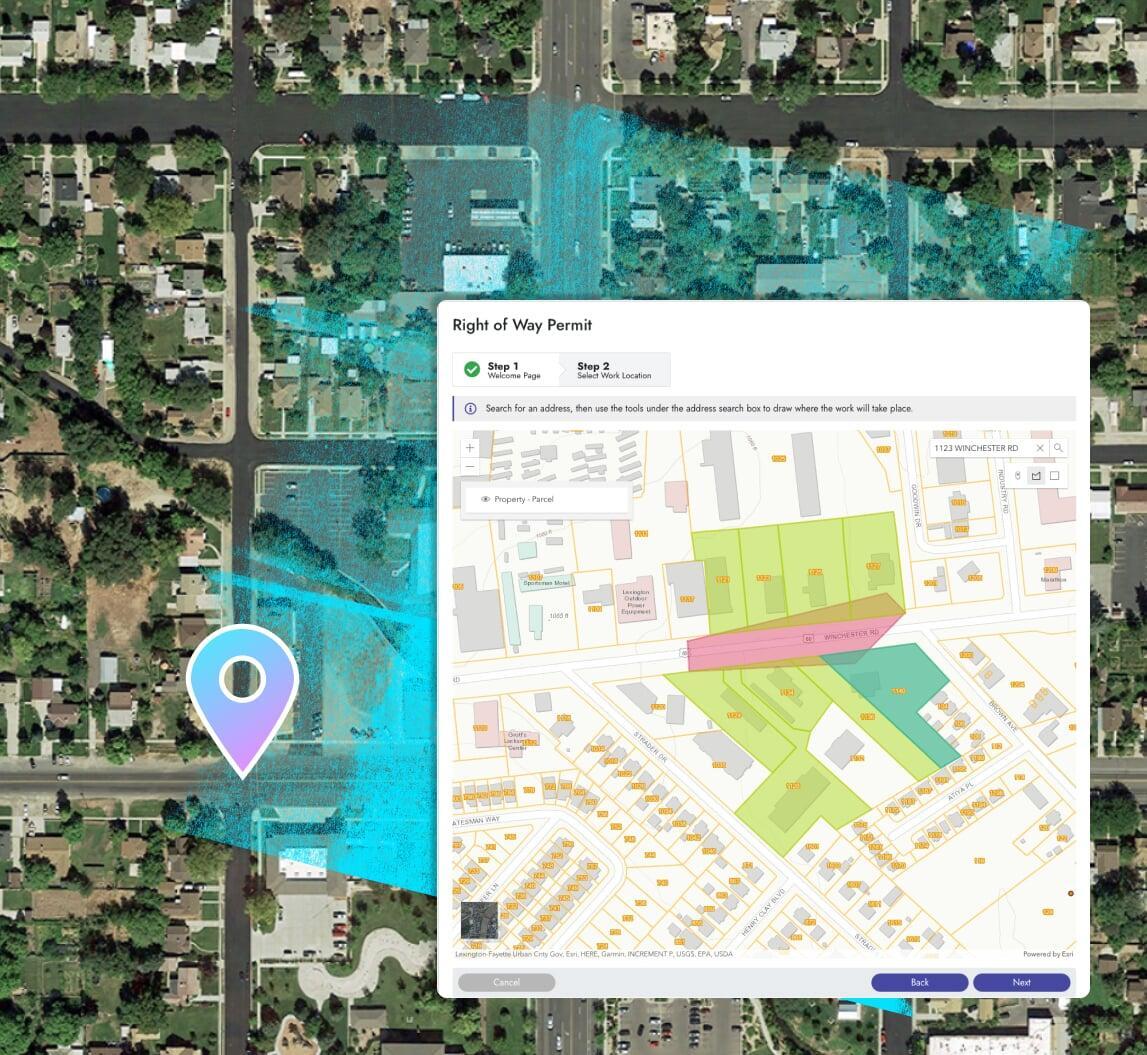
Elements XS offers the best possible integration with Esri's ArcGIS system.
Use your native web maps, apps, and more throughout Elements XS.
Ditch the data synchronization
Your GIS acts as the singular, authoritative asset repository for all things spatial. Elements XS makes synchronizing or copying data to and from your GIS a thing of the past.
Share your maps
Use ArcGIS to create live public facing maps with real-time asset management, billing, and project information.