
Building Permits
New construction, commercial, residential, go down the list. Track everything including the permit application, fees, inspections, permit delivery and more.

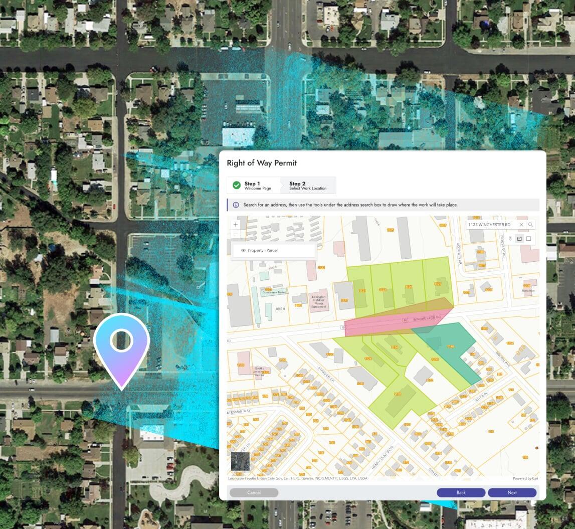
Right of Way Permits
Utilities, obstructions, events, and more. Track authorized applicants, contractors, application details, inspections, fees, and all other details.

Any Application
Land use, conditional use, special events, sewer taps, water rights, and any other type of permit found at a utility or local government entity.
How we stack up
This is not a pre-boxed permitting app, it's is a flexible enterprise platform used across many departments.
Completely integrated with your GIS, asset management, citizen requests, billing, and more.
Us
Them
Features you'd expect
Unexpected innovation throughout
Online portal, mobile friendly
Online payments
Collect fees at any step of the process and collect payments that match your unique fee structures.
Inspections, certificates + more
Create unique inspection processes and certificate issuance policies to ensure compliance and provide the best possible user experience.
Documents
Define documents and attachments for each type of application to help reduce incomplete submittals.
Plan reviews
Easily manage different versions of plan reviews and other required documents with each permit application.
Reports + dashboards
Use the included designers to create new or modify pre-built reports in a snap. Leverage the seamless ArcGIS integration for map-based analytics.
One Platform. Clear Insights.
Better Results.
Asset Management
There's no need to integrate with an asset management system because it's delivered with Elements XS. Tracking inspections, costing details, and work performed against permit applications has never been more seamless.
Calendars + scheduling
Built-in calendars help balance the workload and optimize inspection scheduling.
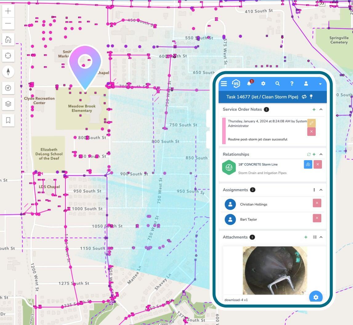
Inspections
Track specific inspection details, status, required follow up actions, and much more with highly-configurable inspection forms.
Reports, dashboards, & analytics
Use the included designs to create new or modify pre-built reports in a snap. Leverage the seamless ArcGIS integration for map-based analytics.
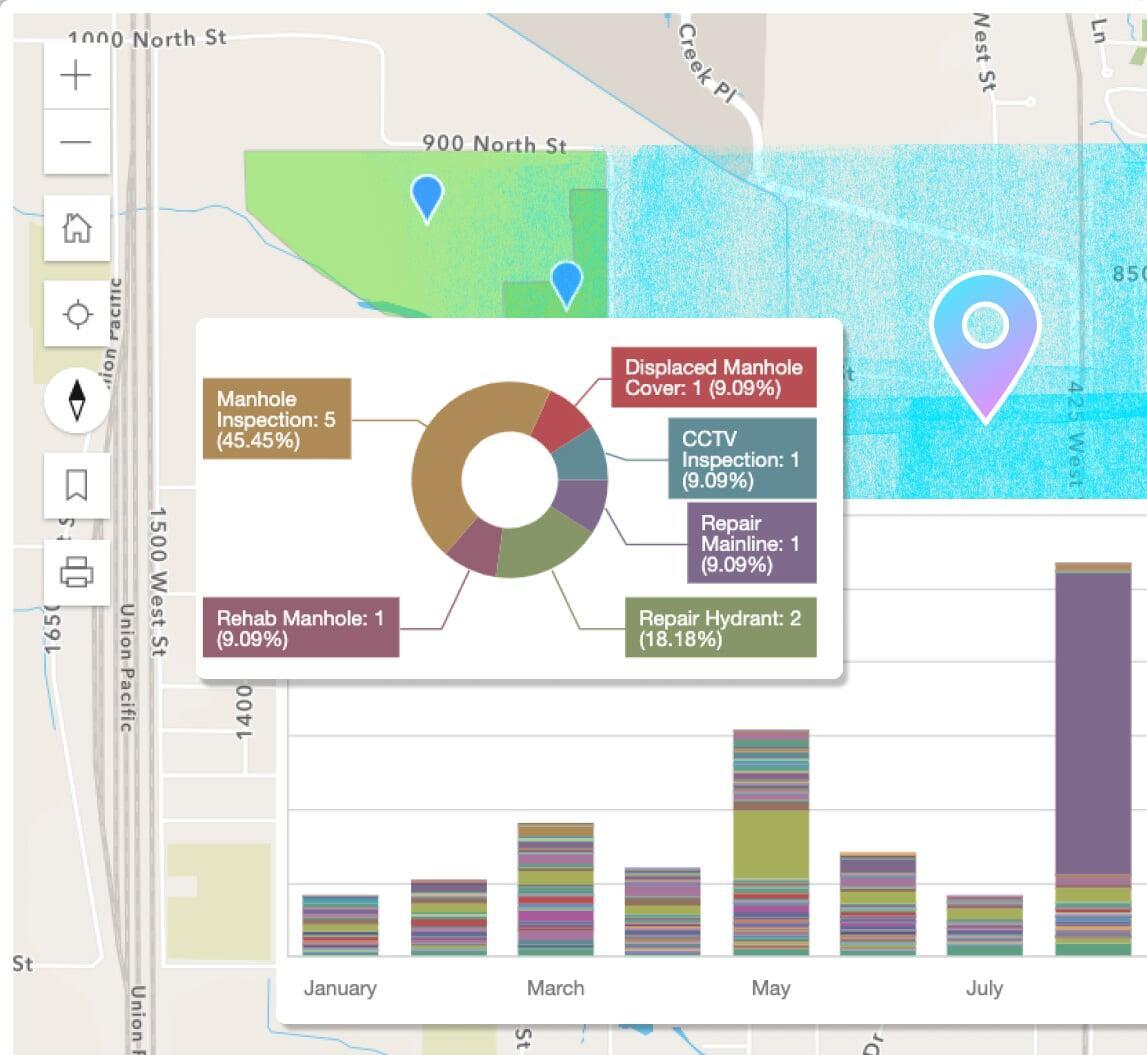
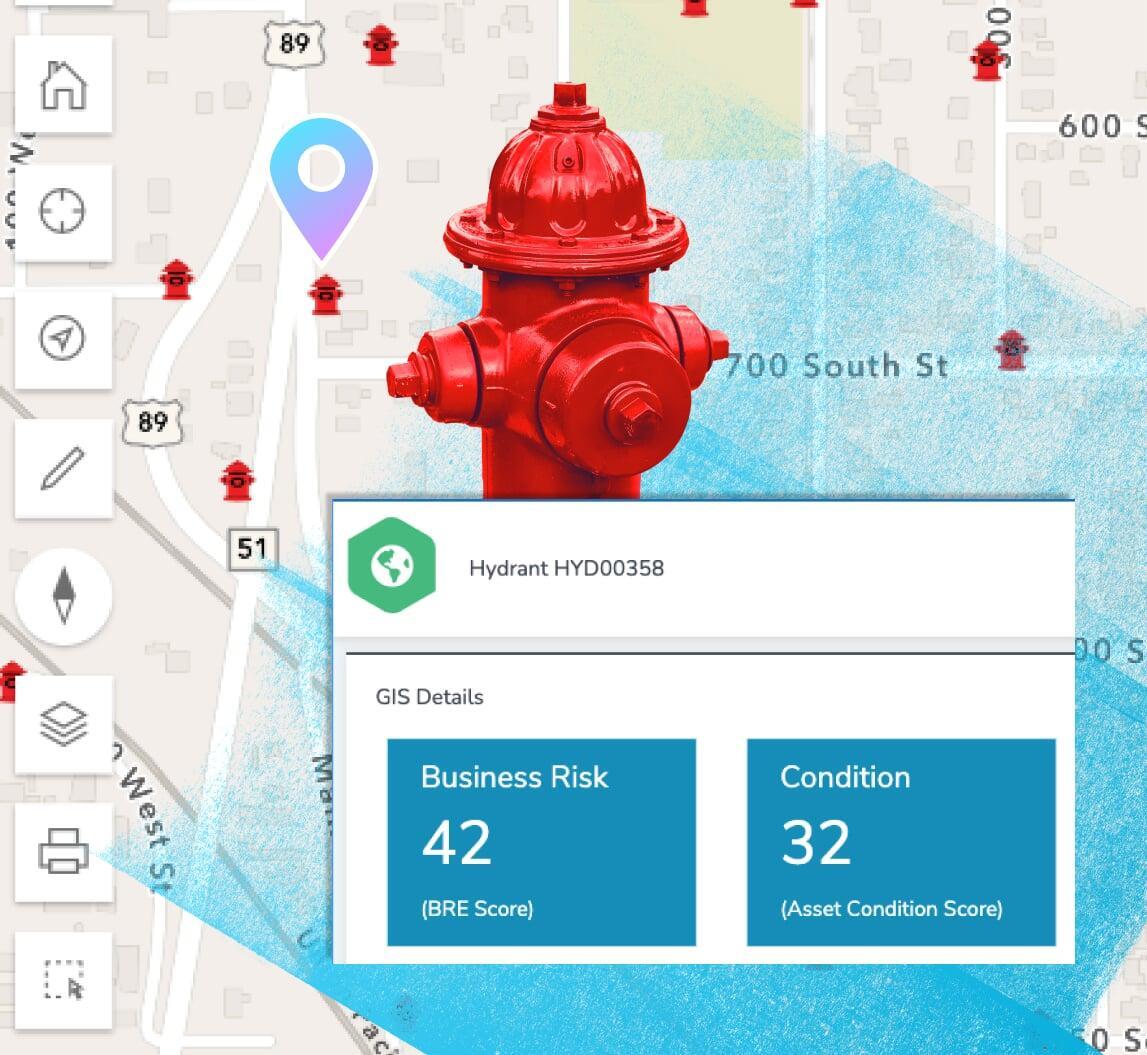
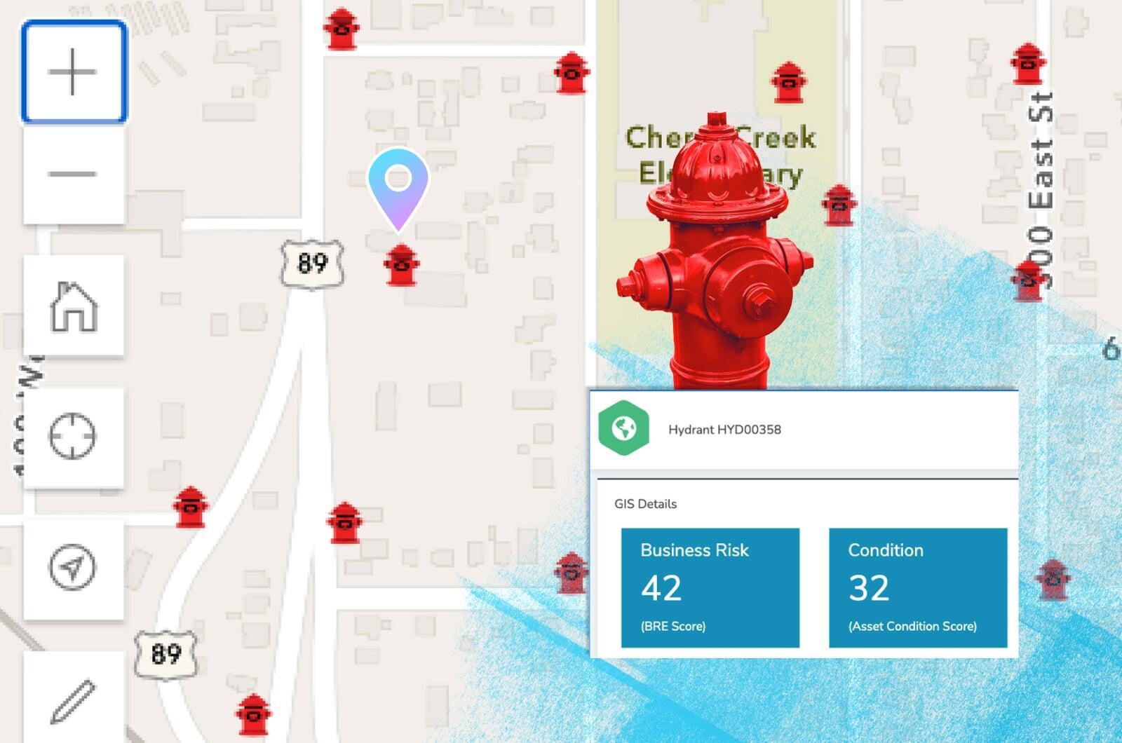
Business risk & asset scoring
Prioritize critical infrastructure with scoring and risk management factors including probability of failure, consequence of failure, and more.
Maintenance: preventive & routine
Schedule maintenance based off of calendar dates, completed maintenance tasks, mileage, runtime hours, and other user-definable metrics.
Create your ideal user experience
Easily tailor the interface with unlimited custom fields,
forms, and automations
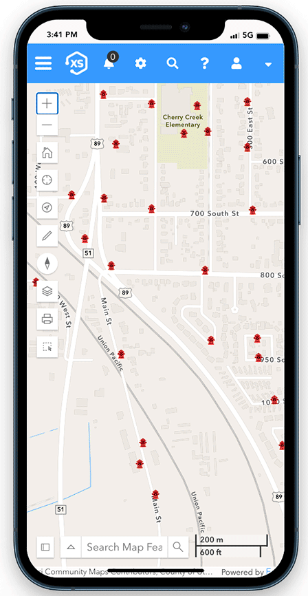
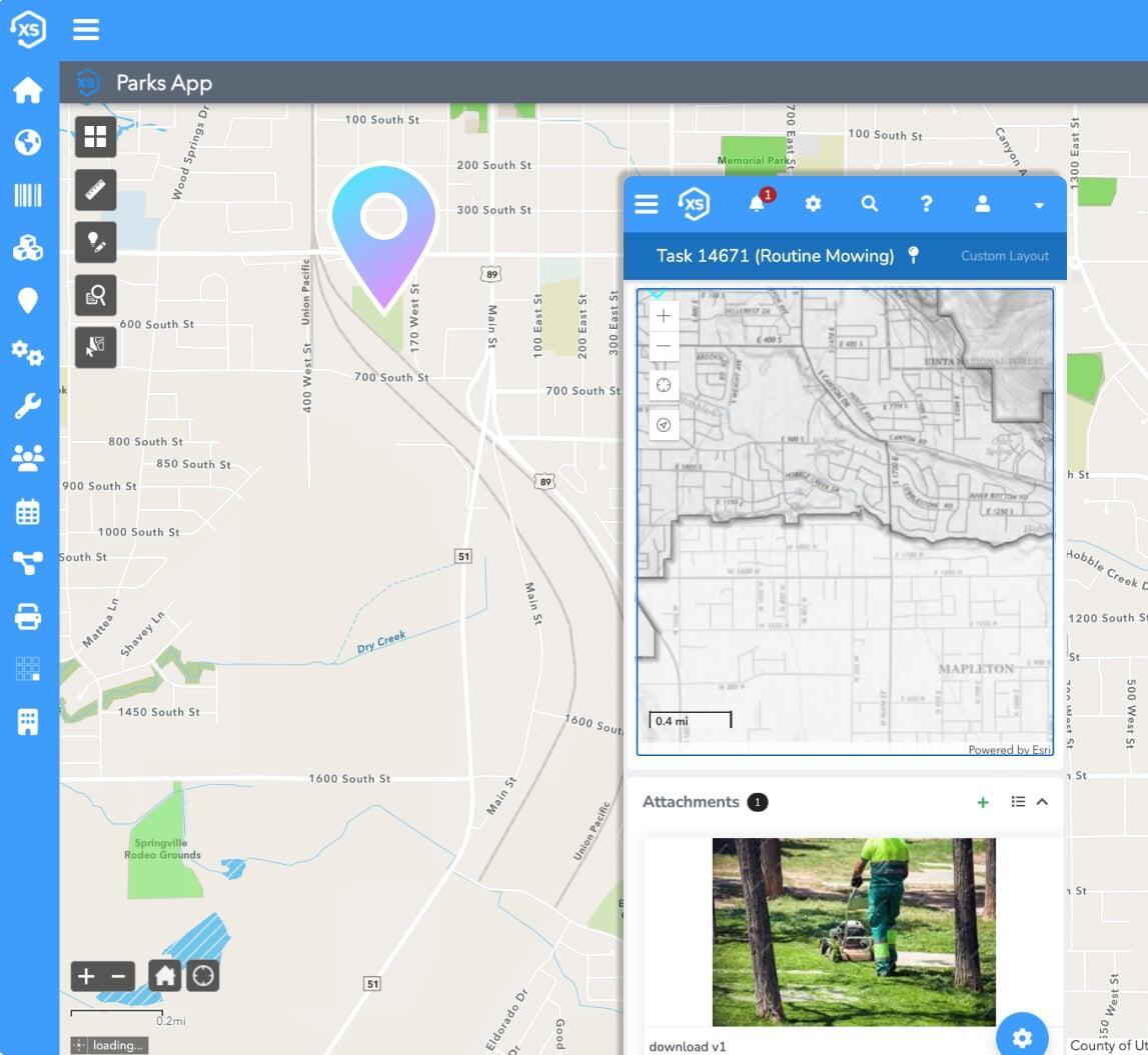
Leverage your maps
See where inspections are required, statuses, open applications and so much more.
Direct, real-time ArcGIS integration
Our live integration with Esri's ArcGIS system provides unmatched flexibility and offers the best possible user experience. Use your native Esri web maps, apps, and more directly in your public facing and internal permitting systems.
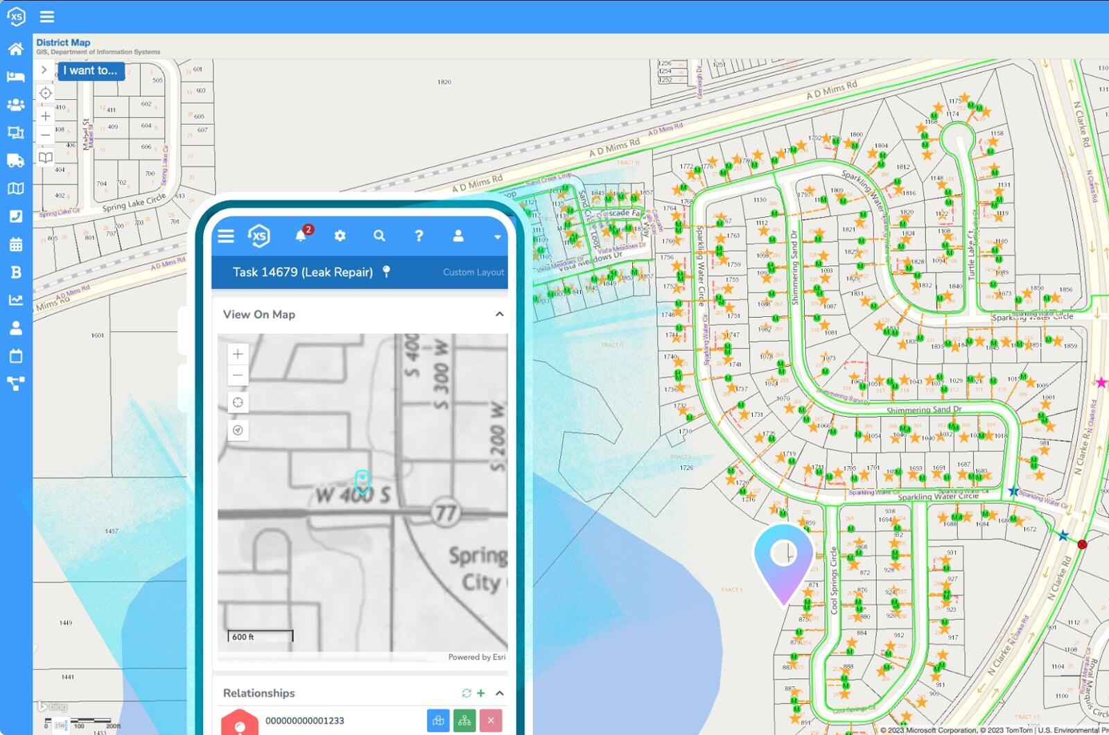
Share your maps
Permitting and application data is displayed in real-time within Esri's ArcGIS system. Use your GIS to share maps with open projects, statuses, inspection details, and much more.