
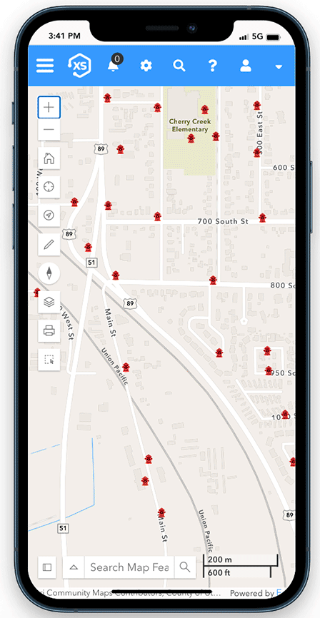
See everything
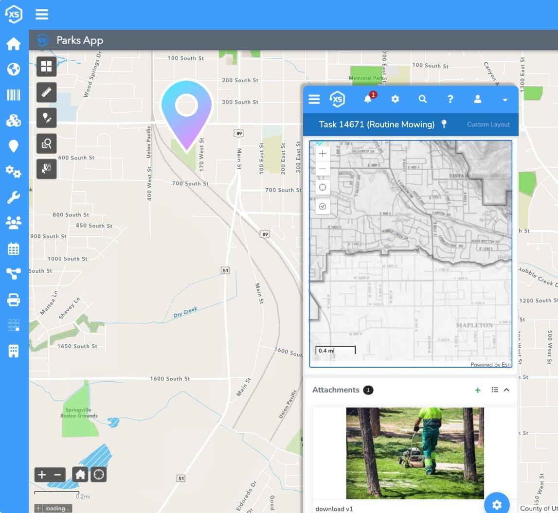
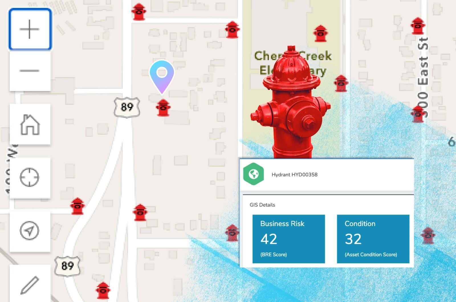
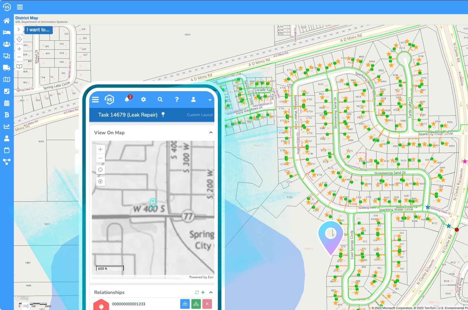
A direct, real-time integration with Esri's modern ArcGIS platform makes visualizing your data a breeze and gives unmatched insight to where things are happening.

Experience the dream
The best possible user experience starts here with the most flexible solution on the market, complete with user-definable automations, forms, datasets and more.

Just one system
One interface to interact with all of your information. No need to switch between integrated apps because this is the app. Modern, flexible tech done right.


What makes us unique?
Us
Them
One Platform. Clear Insights.
Better Results.
Asset Management
All the tools you need to manage every asset, prioritize work, and make data-driven decisions. Business risk calculation, asset and condition scoring, optimized maintenance schedules, advanced analytics and so much more.

Requests +
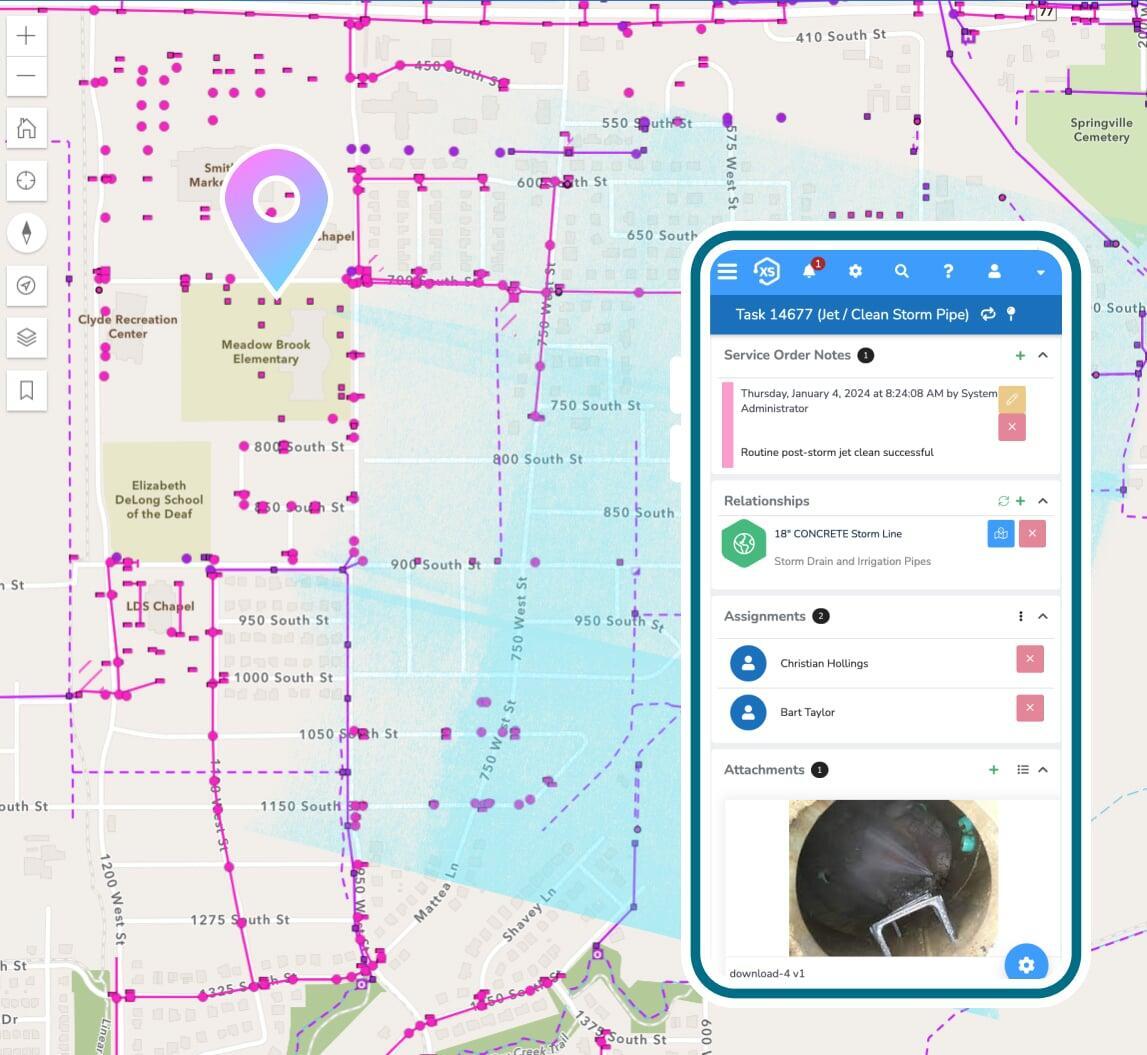
Work Orders
Process inbound requests with a custom branded portal. Create work orders to track labor, materials, and equipment costing information. Keep your citizens informed as work is completed and measure performance against service level commitments.
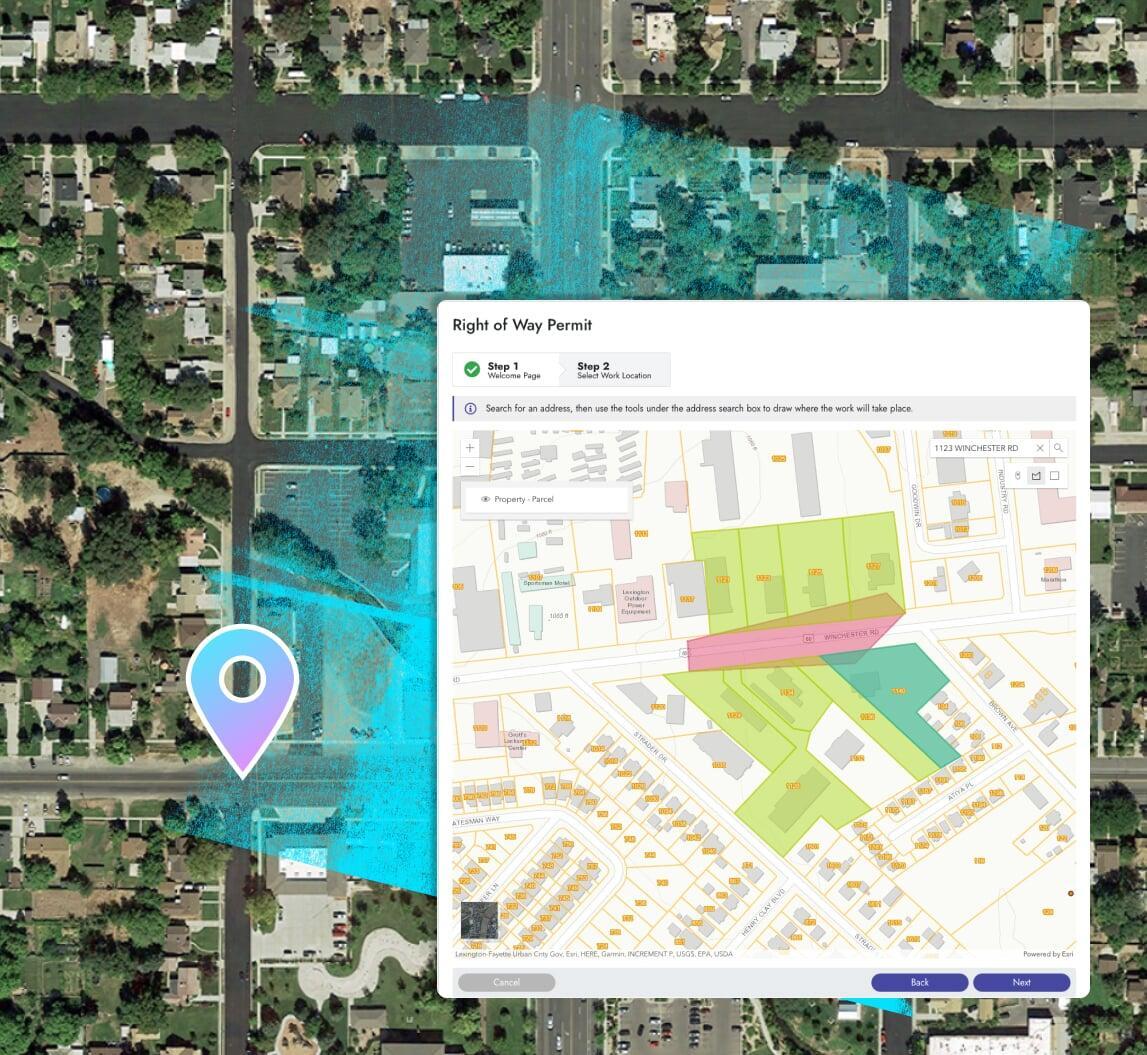
Permits & Online Applications
Process any inbound permit or application. Everything from right-of-way permits to building permits, with all related inspections and certificates, can be easily managed in a unified interface.
Transform your public works
Into public works-way-better
Work from anywhere
Manage costs
Track purchasing, receiving, job costing, and so much more. Optimize procurement processes from start to finish to get things done faster and cut costs.
Use your maps
The best integration with Esri's ArcGIS system you'll find, period. Use your native web maps, apps, and more throughout the platform for the best possible user experience.
Find critical assets & prioritize work
Put your energy into a data-driven, non-subjective work queues.
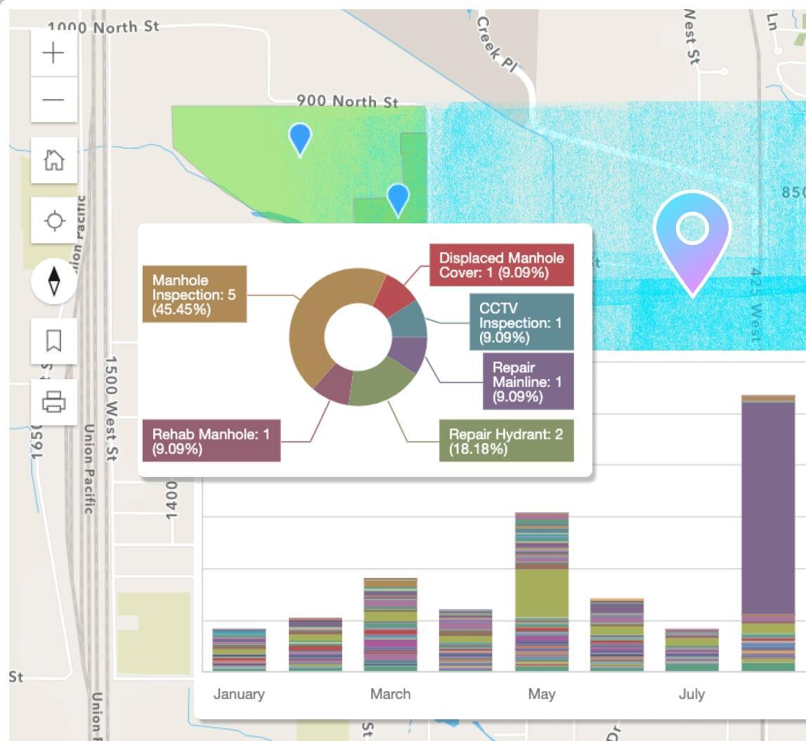
Reports, dashboards, & analytics
Use the included designs to create new or modify pre-built reports in a snap. Leverage the seamless ArcGIS integration for map-based analytics.
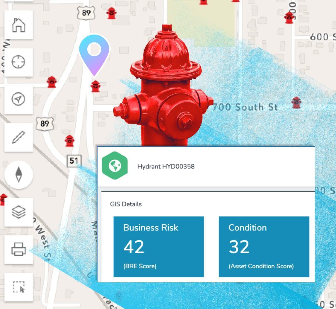
Business risk & asset scoring
Prioritize critical infrastructure with scoring and risk management factors including probability of failure, consequence of failure, and more.
Define probability of failure, consequence of failure, and other risk factors using the highly adaptive scoring module to manage unique infrastructure scenarios.
Maintenance: preventive & routine
Schedule maintenance based off of calendar dates, completed maintenance tasks, mileage, runtime hours, and other user-definable metrics.
Create your ideal user experience
Easily tailor the interface with unlimited custom fields,
forms, and automations
Don't worry be mappy
Ditch the data synchronization
Your GIS acts as the singular, authoritative asset repository for all things spatial. Elements XS makes synchronizing or copying data to and from your GIS a thing of the past.
Share your maps
Use ArcGIS to create live public facing maps with real-time asset management, billing, and project information.