We're proud to be a long-time Esri partner with
aligned vision and technology.


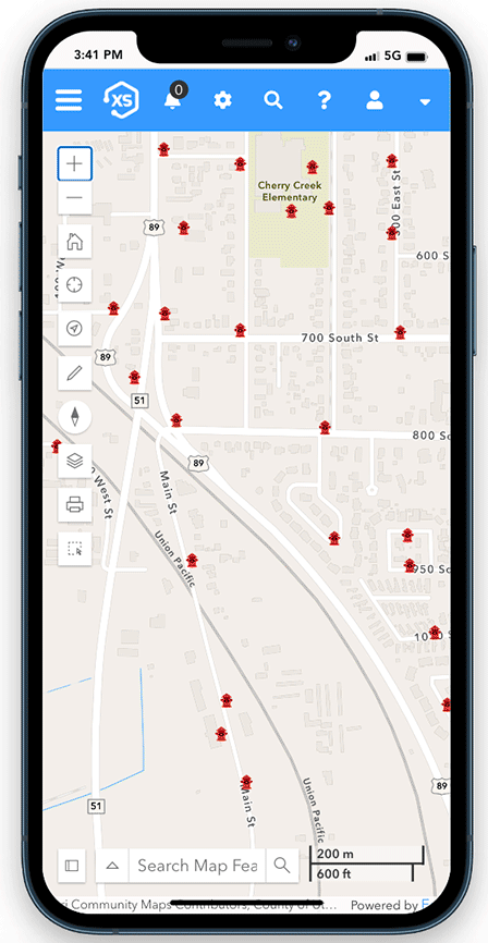
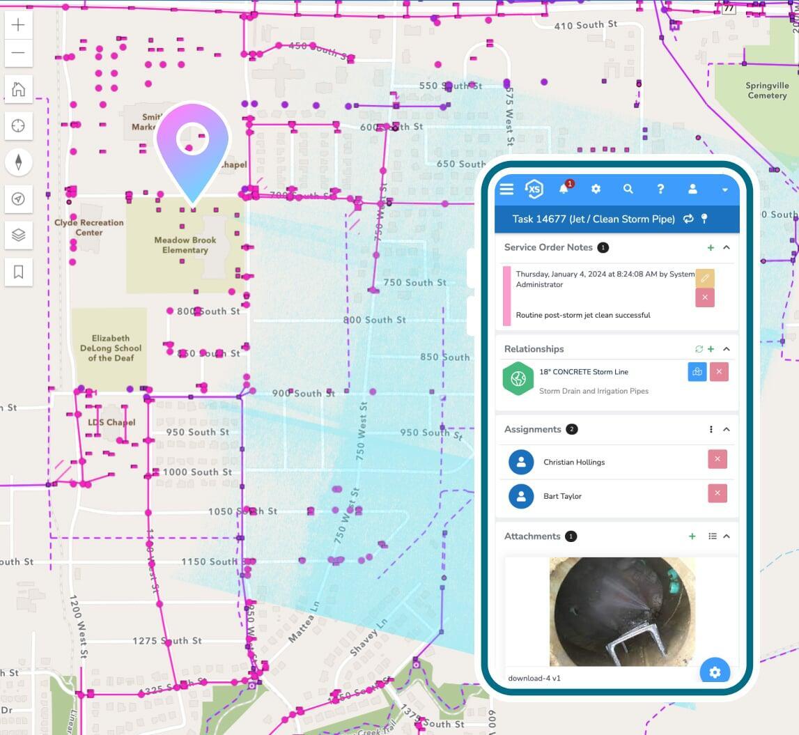
Direct, real-time maps
Use your native GIS as the singular, authoritative data source for all things spatial with a direct integration to Esri's modern ArcGIS platform. Use your native web maps, apps, and more throughout the entire platform. No data copying or synchronization. Period.

Maps everywhere
Maps on work orders, citizen requests, utility bills, permits, and everything else. Unlimited purpose-built maps for different users, different types of records, activities, and so much more. Maps everywhere, on everything, all directly using your native Esri tech.

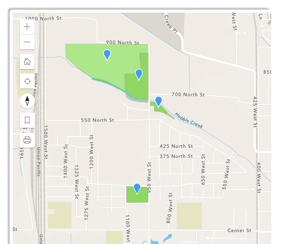
See everything on maps
See locations of work orders, requests, permits, billing data and nearly anything else you can imagine, all in the same application with our direct ArcGIS integration. Maximize your GIS investment and gain a better understanding of where things are happening.locations of work orders, requests, permits, billing data and nearly anything else you can imagine, all in the same application with our direct ArcGIS integration. Maximize your GIS investment and gain a better understanding of where things are happening.
What's the difference?
Our approach to integrating GIS is different and we think you'll like it.
Us
Them
Read and write in real-time
Update feature data directly from our system and/or update our data via native Esri tech to seamlessly share data and provide the ultimate user experience.
Permissions are controlled at the user level via Esri credentials and all map interactions are real-time.
Eliminate duplicate data
Connect directly with an unlimited combination of web maps, scenes, and feature services that have been published via Esri's ArcGIS Enterprise and/or ArcGIS Online.
No limits to the number or types of maps or services that can be utilized, so long as they are supported by the native Esri platform.
See everything
Leverage geoJSON, query layers, and other native Esri tech to geographically represent any dataset across the enterprise. .
Any modern Esri tech
Fully integrated to maximize your GIS investment.
Map-based analytics
Use native Esri analytics tools to gain real-time insight into your enterprise asset management, billing, and more.

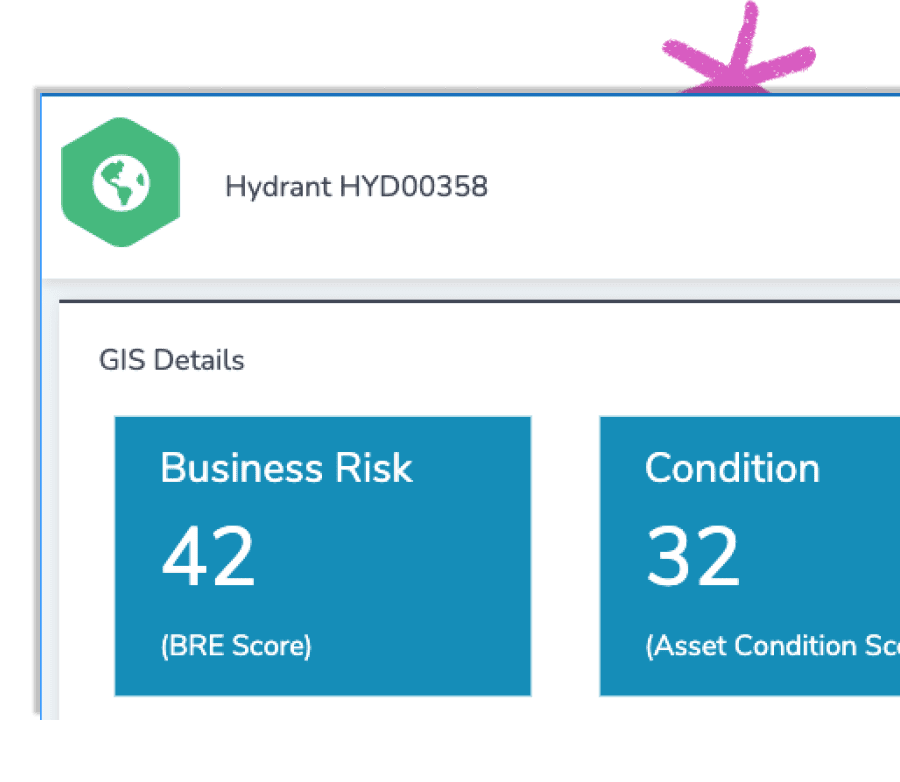
Mitigate business risk
See where high risk assets and infrastructure are located and prioritize efforts with our native GIS integration.
Location services
Use location services to automate work assignments, create driving routes, see where crews are located, and much more.
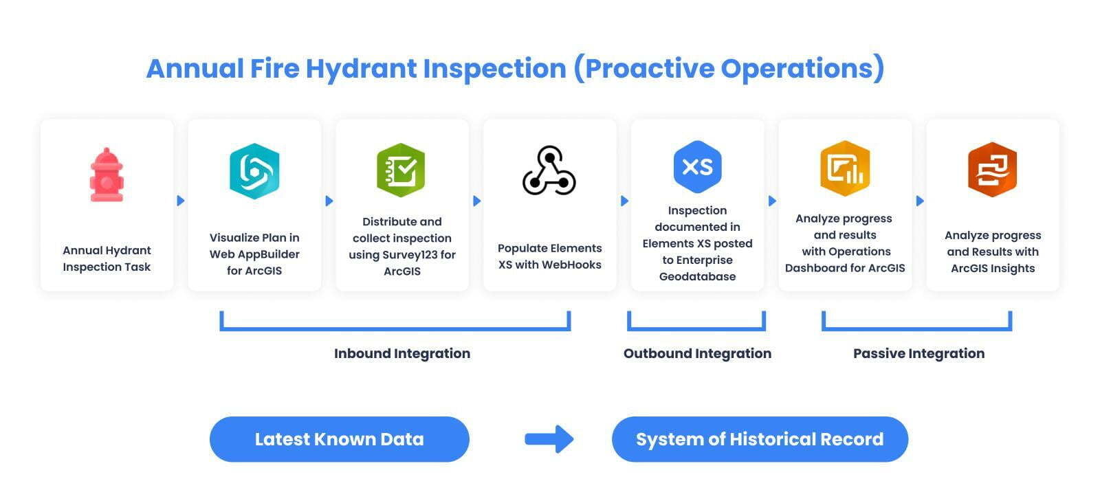
How does the integration work?
Glad you asked.
Elements XS - ESRI Integration Model

A critical piece of the Esri ecosystem
Augment the apps and solutions you've built with Esri.