CITIZEN & CONTRACTOR PORTAL FOR UTILITIES & LOCAL GOVERNMENT

At last, a better way to connect
With your citizens and contractors

Citizen Requests
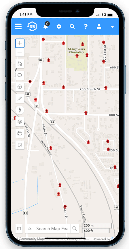
Connect includes out-of-the-box tools to get running with citizen requests. Citizens can report issues on the map, submit photos, and stay in the loop as issues are resolved.

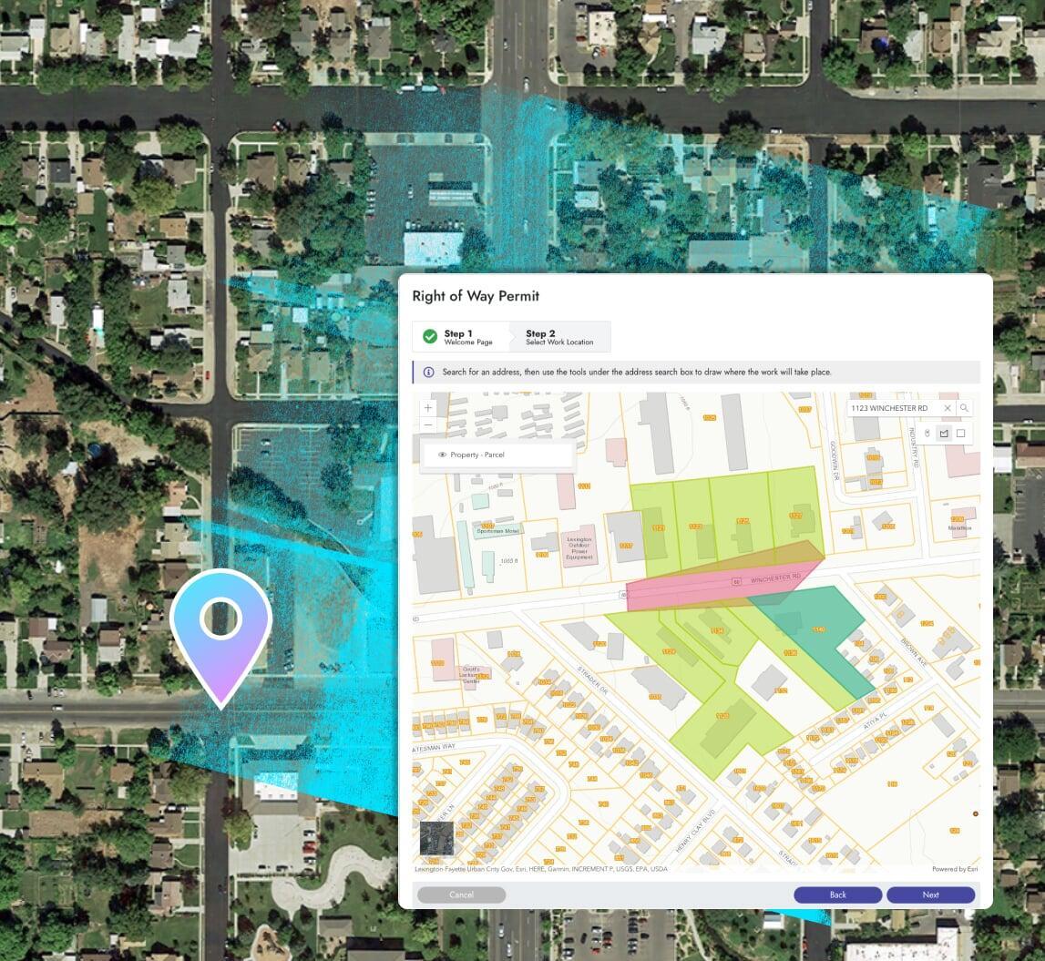
Permits & Applications
Advanced configuration of Connect provides solutions for building, right-of-way, and other permit types. Start to finish, including online payments, inspections, and more.

Anything Else
Connect is a modern, flexible public portal that allows you to create any set of data collection forms, then group and associate those with user-definable automations. It's big.
Made for everyone at your organization
This is not a one-trick pony for one department.
Connect is a fully integrated enterprise application that processes all types of inbound requests and
applications for all departments.
Report Concerns
Apply for Permits
Pay Fees Online
Request Services
What's the difference?
Elements XS has been carefully crafted to balance extreme flexibility with simplicity, practicality,
and the best possible integration with Esri's ArcGIS system.
Us
Them
One Platform. Clear Insights.
Better Results.
Asset Management
Process any inbound request or application with a stunning public portal that showcases your logo, images, colors, and more.

Fees & online payments
Connect integrates with premium payment processors to make paying online easy and help you collect your money faster.
Better notifications
Communicate more efficiently with built-in messaging; keep applicants updated with automated emails for status updates and more.
What can Connect do for you?
More than you think.
Features you'd expect
Innovation that will surprise you
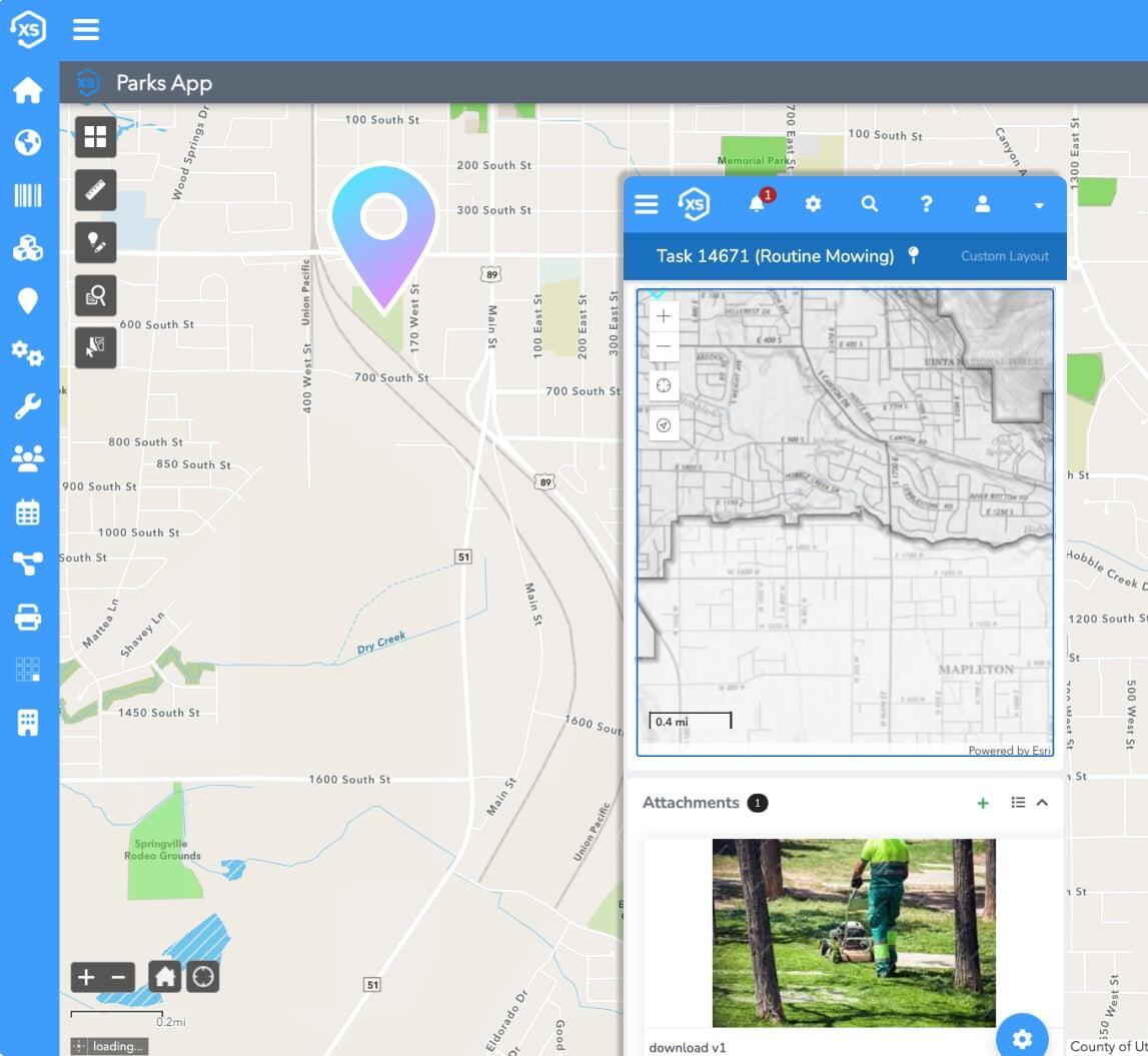
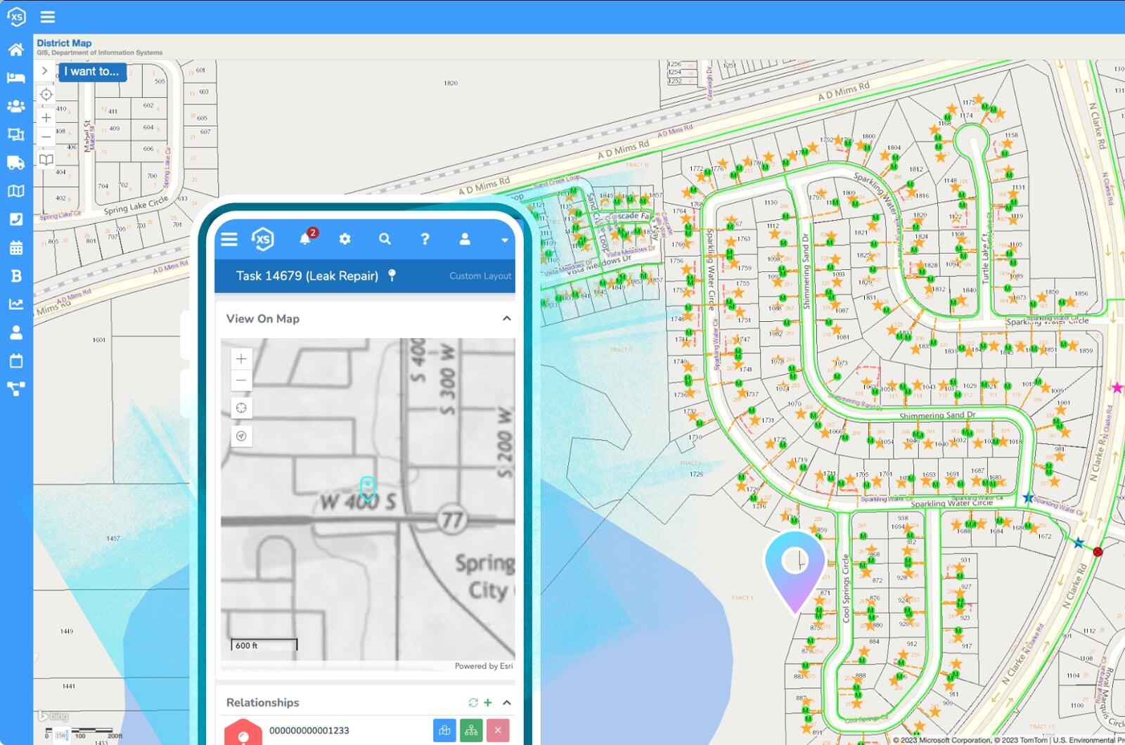
Your maps, with real-time GIS
Ultra-flexible, no custom code
Tailor page layouts and data collection requirements for any process. Set field and document attachment requirements to guide applicants through online submittal processes.
Mobile friendly
Access the app on any device from anywhere with internet access.
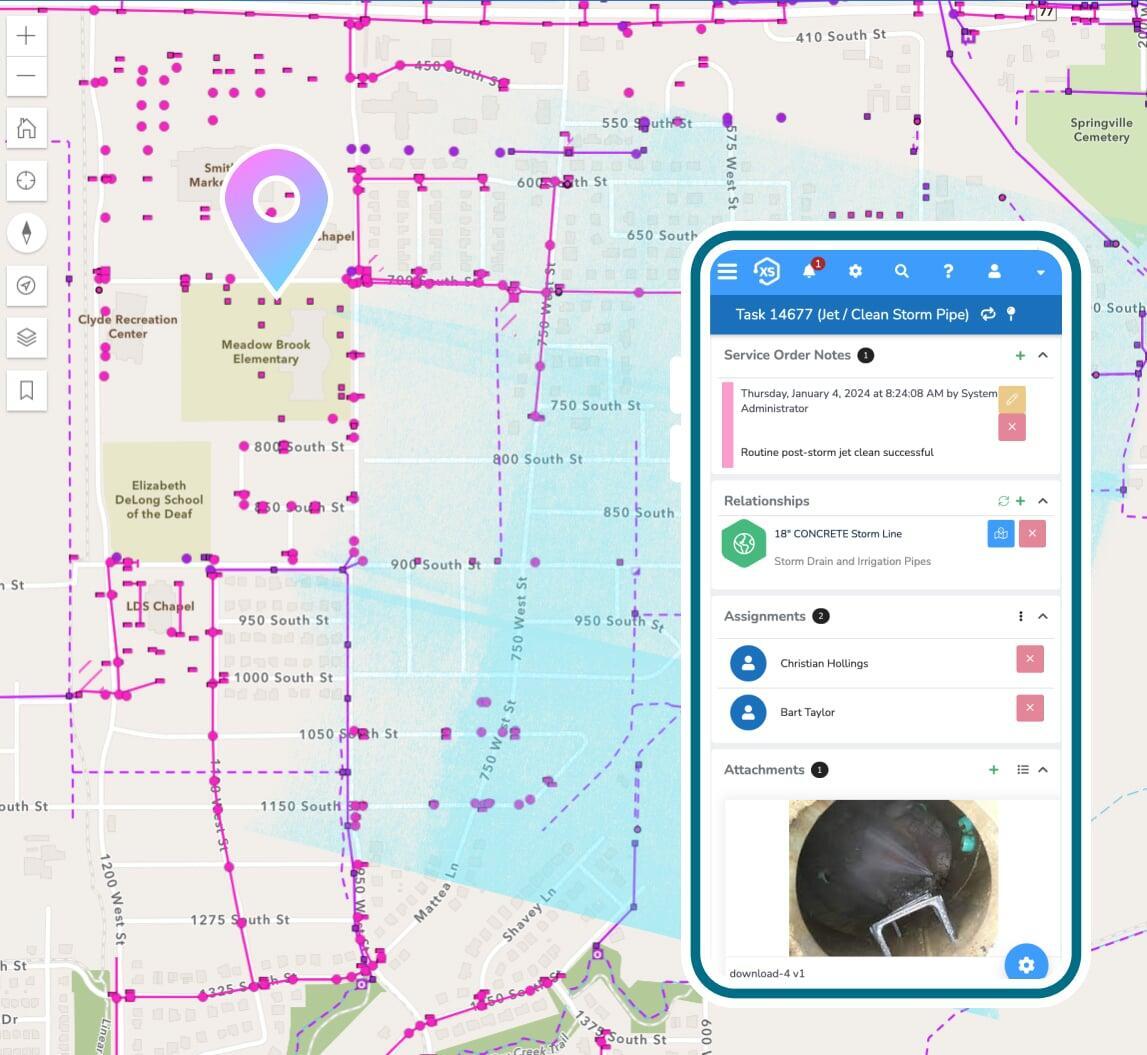
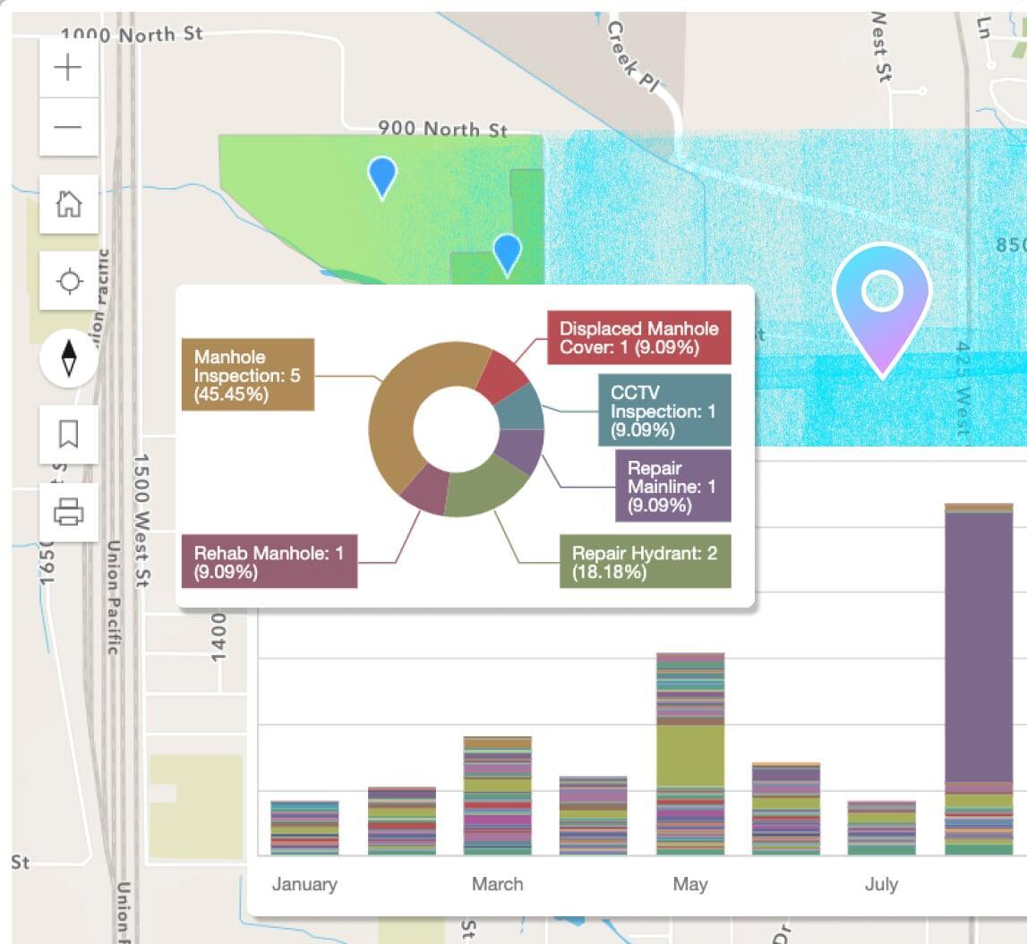
Reports, dashboards, & analytics
Use the included designs to create new or modify pre-built reports in a snap. Leverage the seamless ArcGIS integration for map-based analytics.
Adaptive, modern interface
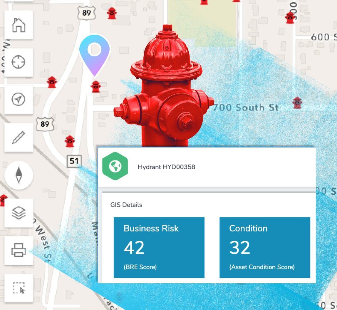
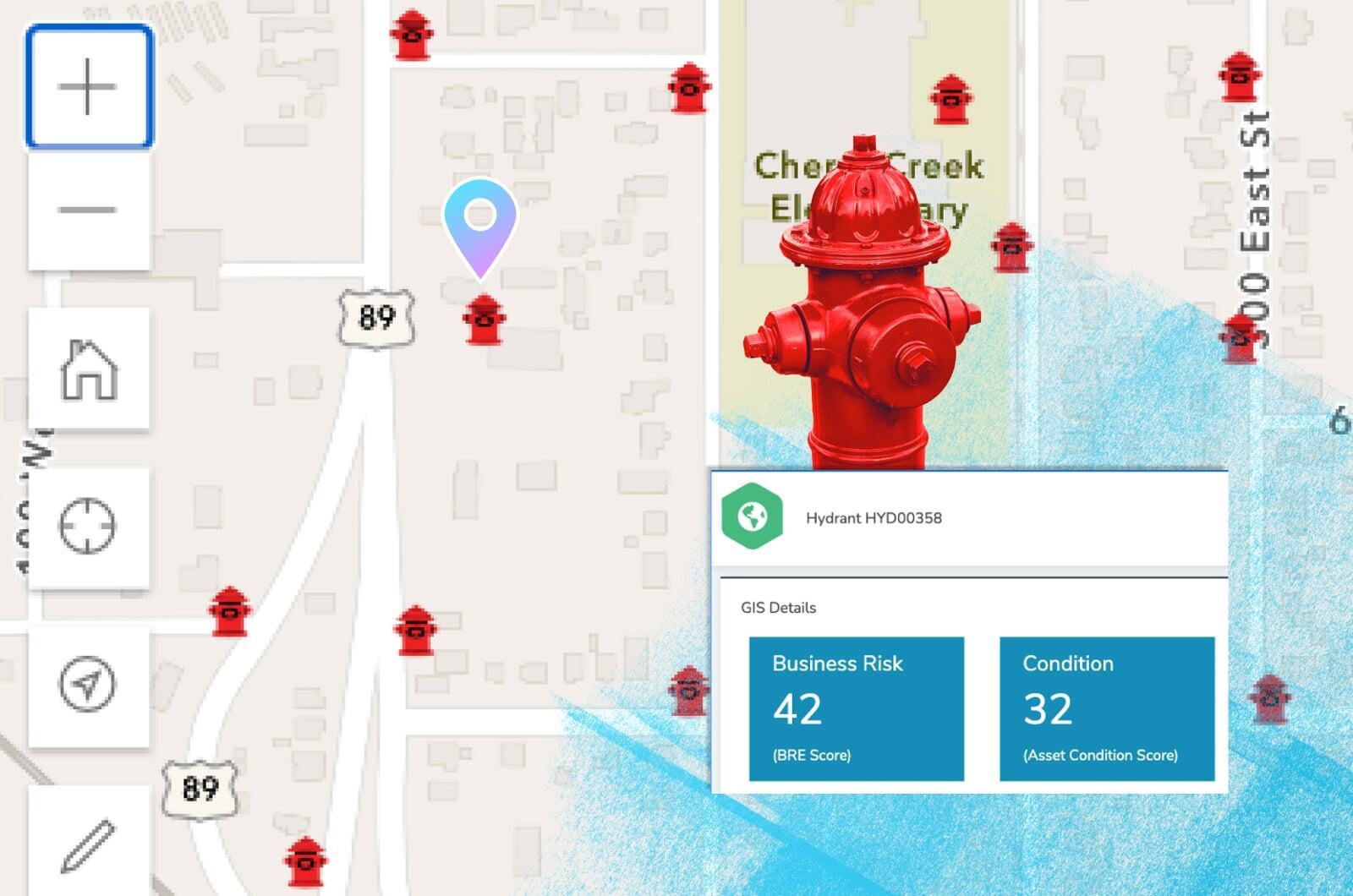
Prioritize critical infrastructure with scoring and risk management factors including probability of failure, consequence of failure, and more.
Plays well with others
In addition to ArcGIS, Elements XS has been integrated with countless other technologies used by utilities and local government.
Create your ideal user experience
Enjoy unlimited custom fields, forms, and automations
Don't worry be mappy
Connect offers the best possible integration with Esri's ArcGIS system.
Use your native web maps, apps, and more throughout Connect.
Ditch the data synchronization
Your GIS acts as the singular, authoritative asset repository for all things spatial. No more synchronizing or copying data to and from your GIS. You're welcome.
Share your maps
Use ArcGIS to create live public facing maps with real-time Connect information including request statuses, open projects, areas of concern, and so much more.