
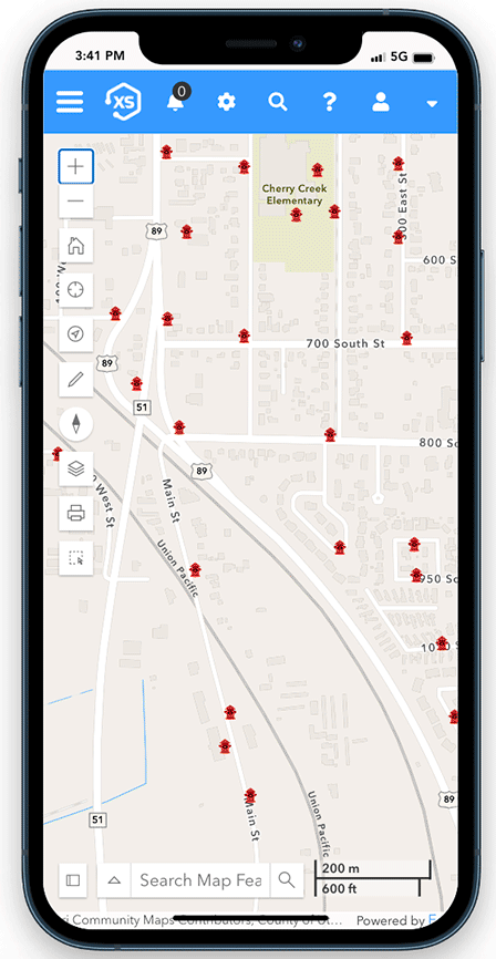
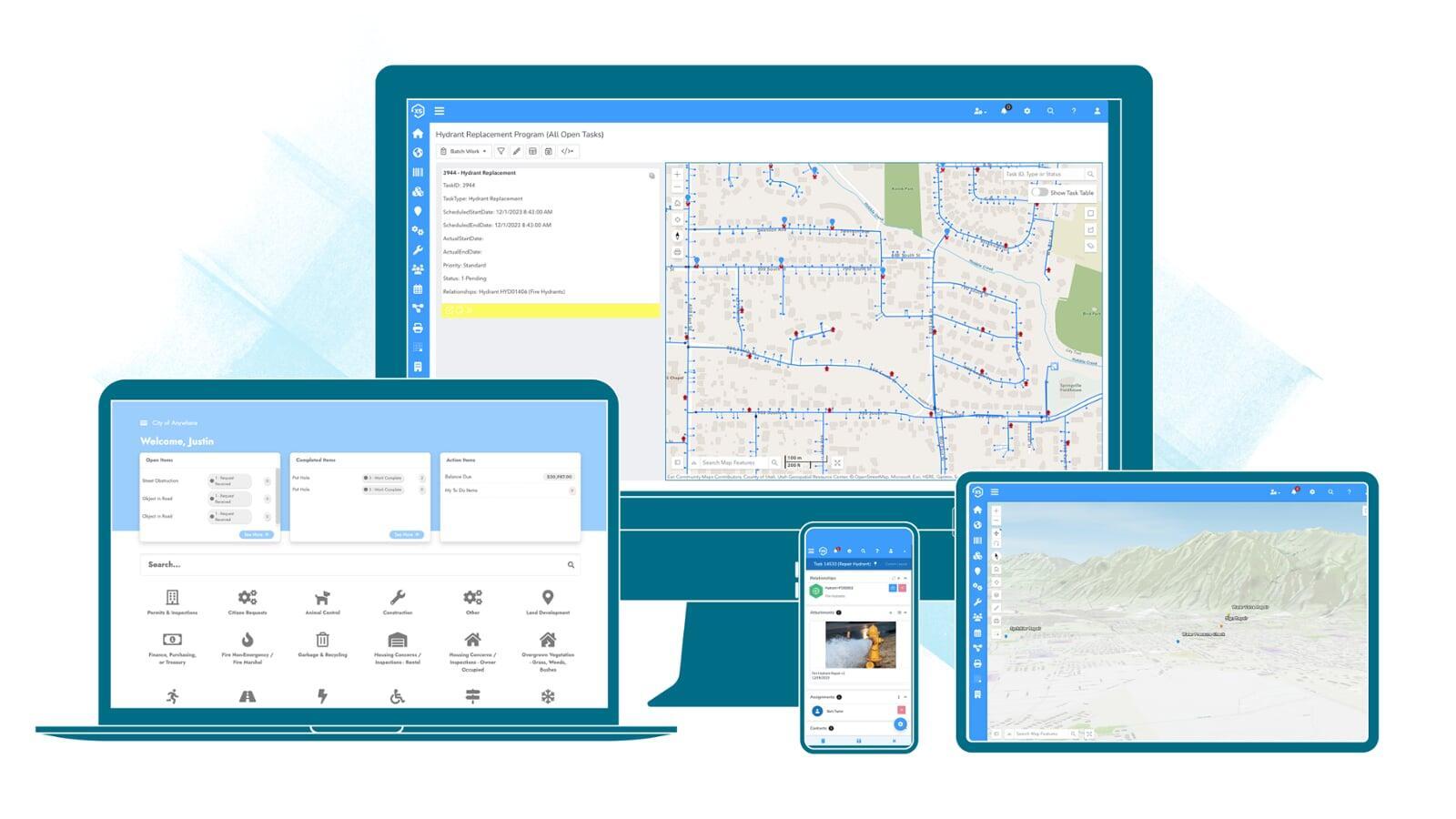
Maps everywhere
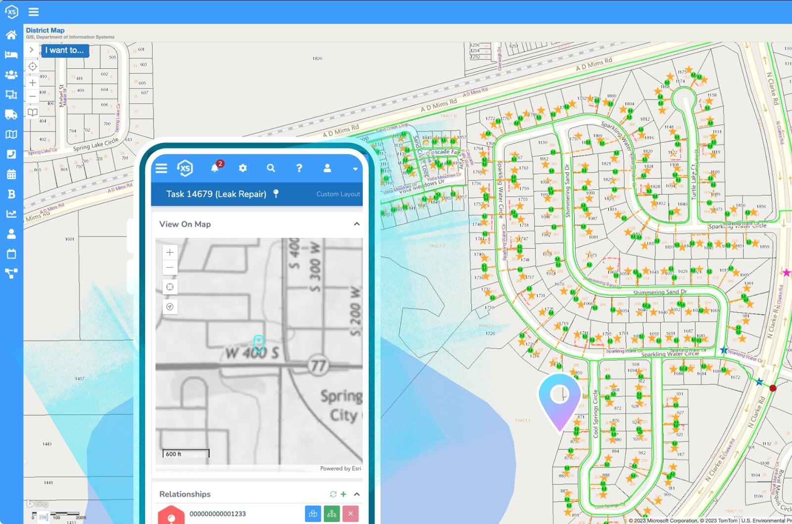
Easily associate land management records with maps using our direct integration with Esri's modern ArcGIS platform. Use your GIS as the singular, authoritative asset repository for all things spatial.

Your ideal UX
Track any type of record or application with the most flexible solution on the market, complete with user-definable automations, forms, datasets and more.

Online processing
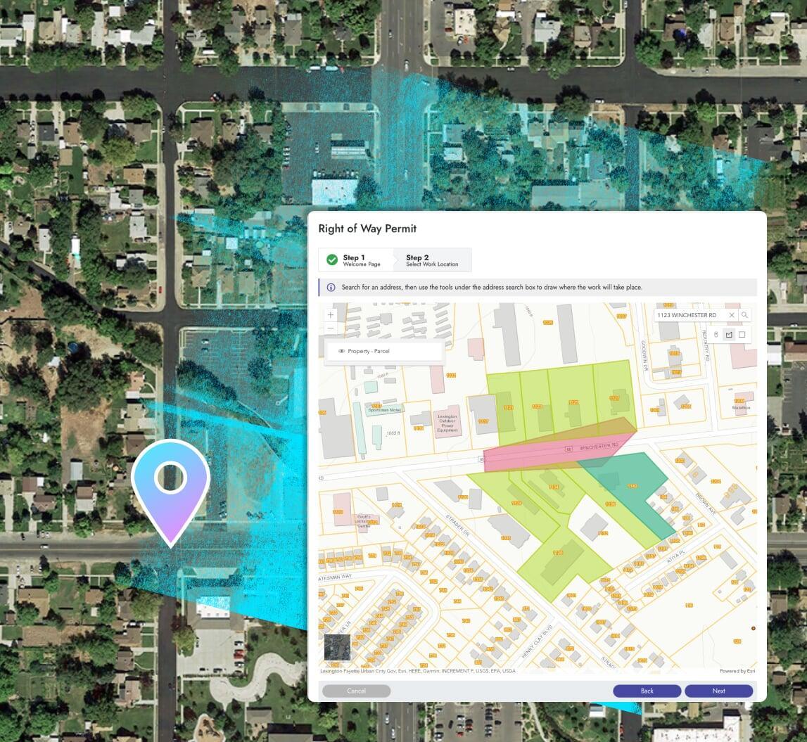
Receive any application through a custom branded online portal, making it easier for your constituents to submit applications and easier for you to process them.online portal, making it easier for your constituents to submit applications and easier for you to process them.online portal, making it easier for your constituents to submit applications and easier for you to process them.


Features you'd expect
Unexpected innovation throughout
Process any application online
Process payments online
Collect payments online and configure unique fee structures for different types of applications.
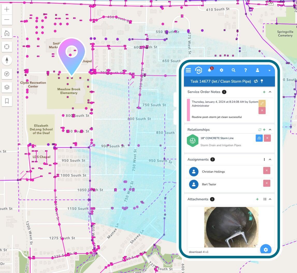
See everything on your maps
All data is seamlessly integrated with Esri's ArcGIS system, eliminating data duplication and GIS synchronization complications. Our real-time connection utilizes your GIS as the singular asset repository for all things spatial.
Manage your land like a champ
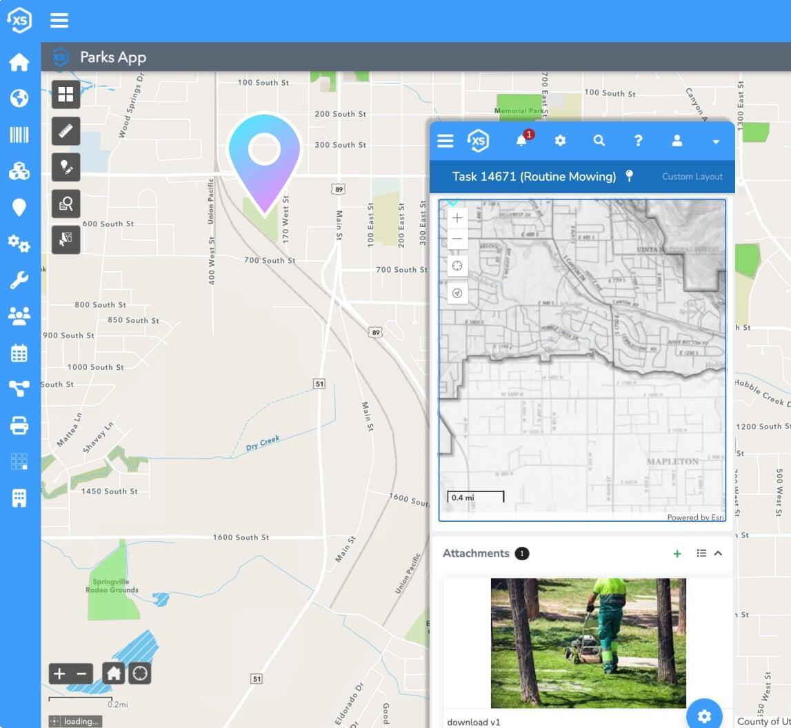
Asset + work management
Track any type of work and all critical details for any asset or infrastructure on your land. Work orders, maintenance, requests, costing, risk and so much more.

Calendars + scheduling
Built-in calendars help balance the workload to manage inspections, follow-up actions, and more.
Application approvals
Track the status of any application, including approvals and required business processes from submission to completion.
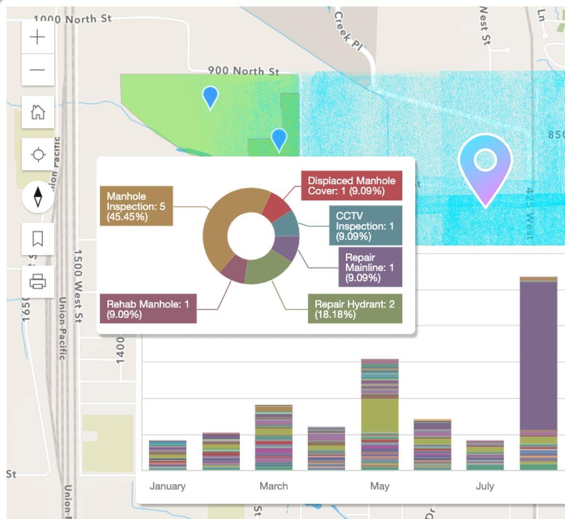
Reports, dashboards, & analytics
Use the included designs to create new or modify pre-built reports in a snap. Leverage the seamless ArcGIS integration for map-based analytics.
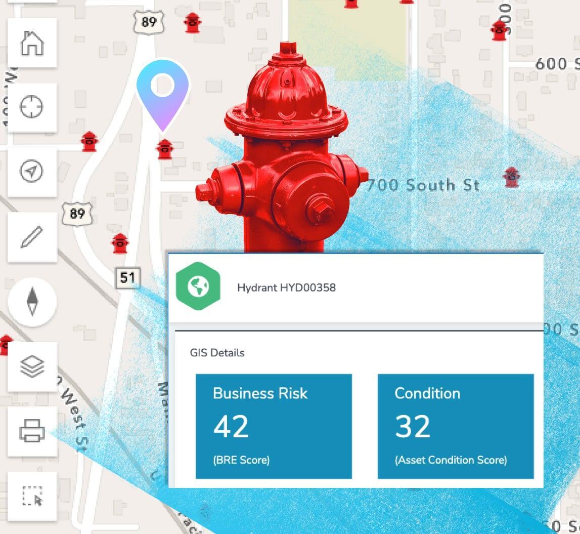
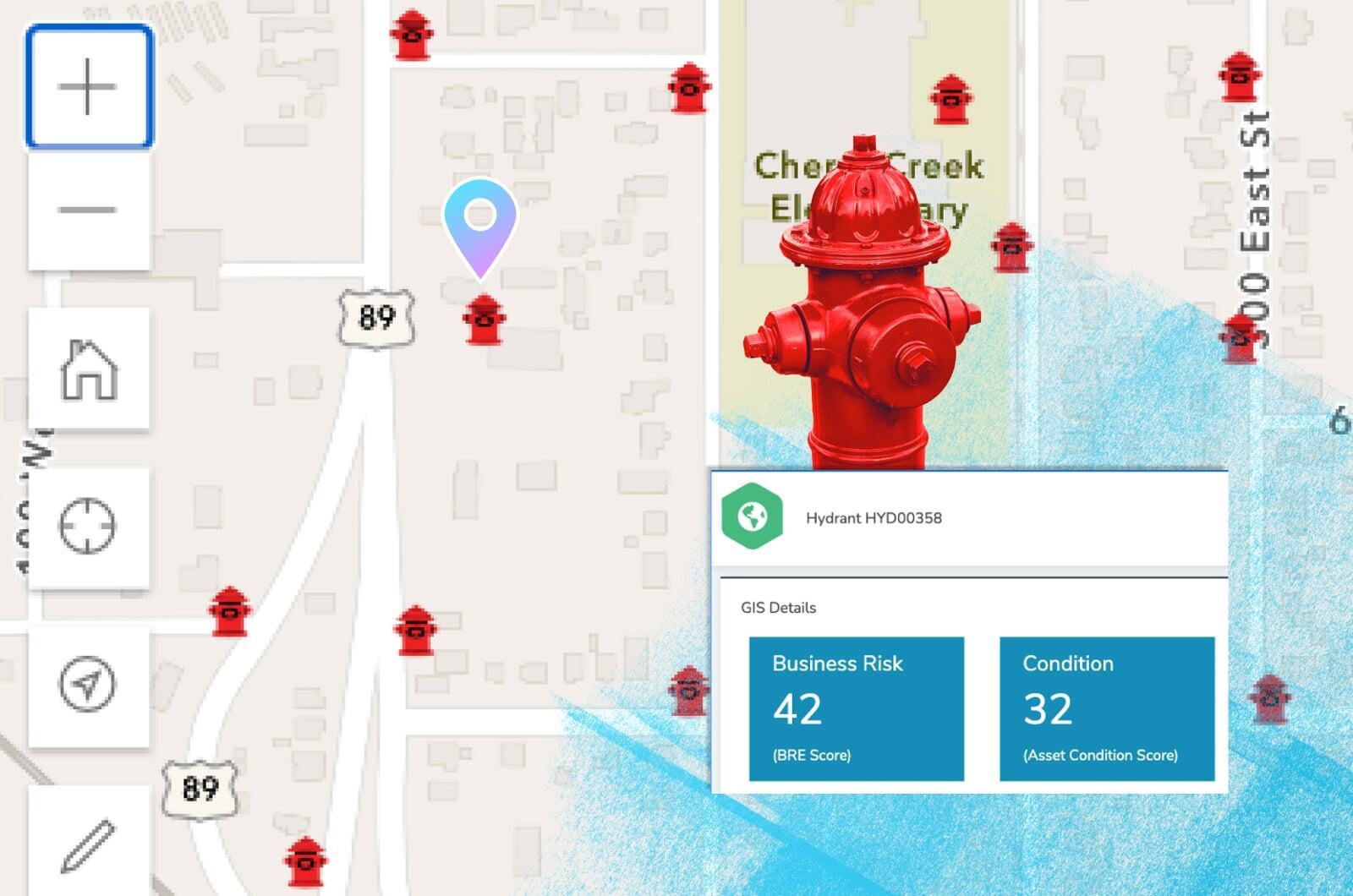
Business risk & asset scoring
Prioritize critical infrastructure with scoring and risk management factors including probability of failure, consequence of failure, and more.
Maintenance: preventive & routine
Schedule maintenance based off of calendar dates, completed maintenance tasks, mileage, runtime hours, and other user-definable metrics.
Create your ideal user experience
Easily tailor the interface with unlimited custom fields,
forms, and automations
Moving forward
Manage critical land
+ prioritize work
Put your energy into a data-driven, non-subjective work queues.
Asset condition assessment
Maintenance & condition scoring
Auto-generate score values when work is performed on any asset. View scoring trends over time and create activity based on scoring data.
Depreciation & valuation
Find assets nearing the end of their lifecycle, including estimated repair and replacement costs. Reporting tools to assist with GASB and PSAB requirements are included.