In cities across the country, aging infrastructure and limited resources often collide, leaving public works departments scrambling to do more with less. But in Orem, Utah, a better story is unfolding—one where the GIS and Public Works teams are leading digital innovation, cross-departmental collaboration, and location intelligence are reshaping how a city manages its most essential systems.
At the heart of this transformation are two powerful platforms: Elements, a customizable asset and work management system, and ArcGIS, the industry leader in GIS, mapping and location intelligence. Together, they’ve become the digital backbone of Orem’s GIS-centric public works operations—from wastewater compliance to pavement preservation—empowering teams to work smarter, faster, and more transparently.
“Our goal has always been to break down silos between divisions,” said Cody Steggell, GIS Manager for the City of Orem. “When water, streets, sewer, and stormwater can share data and workflows in real time, we’re not just solving problems
faster—we’re delivering better service to the community.”
Grease, Grit, and a Best-of-State Award
Olivia Larson, a GIS Analyst with the city, has helped lead a dramatic overhaul of Orem’s Pre-Treatment program, which monitors businesses for compliance with wastewater regulations. “We used to do everything on paper,” she says. “Now, they can do it all in the field—on a tablet, in real time.”
Using Elements integrated with ArcGIS, inspectors can now log pH levels, track chemical tests, and generate inspection notices on-site. “They used to have to type the same data into three different systems,” Larson explains. “Now, it’s all in one place.”
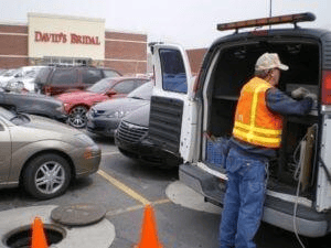
The system automates the chain of custody for lab samples, ensuring regulatory compliance and reducing human error. “We worked with the lab to redesign the form,” Larson says. “Now it prints directly from the truck, gets hand-signed, and goes out with the sample.”
ArcGIS plays a critical role in this workflow. Inspectors use interactive maps to locate grease traps and sample points—often hidden or difficult to access—and view real-time business contact information. “It’s all pulled from the GIS,” Larson says. “If they need to talk to a business owner, the phone number and email are right there.”
The results speak for themselves. The program has not only improved efficiency but also earned statewide recognition. “It cuts their work in half,” Larson says. “And it won the Best of State award from the Water Environment Association of Utah for the City’s Pre-Treatment Program because of how much we’ve improved our processes using Elements and ArcGIS software together. The whole process has become so efficient and well-documented that it really stood out.”
Pavement Management, Reimagined
Jet Buxton, who helped build Orem’s pavement management system, describes a transformation rooted in both data and intuition. “Every road in Orem is inspected every three years,” he says. “We use a scoring system called OCI—Overall
Condition Index—to track the health of our roads.”

But Orem’s rating system isn’t a standard off-the-shelf metric. It’s a custom hybrid model that blends the industry-standard PCI (Pavement Condition Index) with additional factors tailored to Orem’s needs. “Most cities use PCI, which doesn’t take into account ride roughness,” Buxton explains. “We’re factoring in more—like how the road feels and what we know about its history. That’s how our OCI came about.”
The system incorporates:
Various surface distresses (cracks, potholes, surface wear, etc.)
Ride roughness (how the road feels to drive on)
Functional classification (e.g., collector vs. arterial)
Historical data (e.g., past treatments and inspections)
Each road segment is scored from 0 to 100, and degradation is modeled based on road type—collectors, for example, are expected to lose about three points per year. “It gives the inspector a baseline,” Buxton says. “They can still use their judgment, but now they have objective data to guide them.”
This nuanced approach allows Orem to make smarter decisions about when and how to treat roads. “We’re not just collecting data,” Buxton says. “We’re building a system that reflects the real-world condition of our streets.”
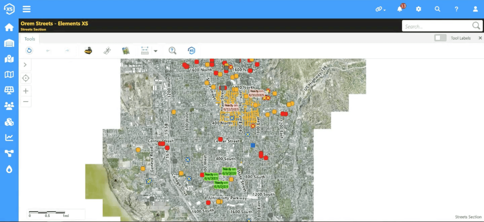
ArcGIS maps provide a visual interface for managing inspections and projects. Roads are color-coded by condition, and inspectors can click on a segment to launch a task, log findings, and update the GIS in real time. “Once the inspection is completed and the data is saved, the road segment disappears from the map because it’s no longer due for inspection,” Buxton explained. “It’s a pretty elegant system—it shows you exactly what’s due and what needs to be done next.”
The system also tracks capital improvement projects. “We do six major street projects a year,” Buxton explains. “Now we can track each one, see what percentage is complete, and report that to management.”
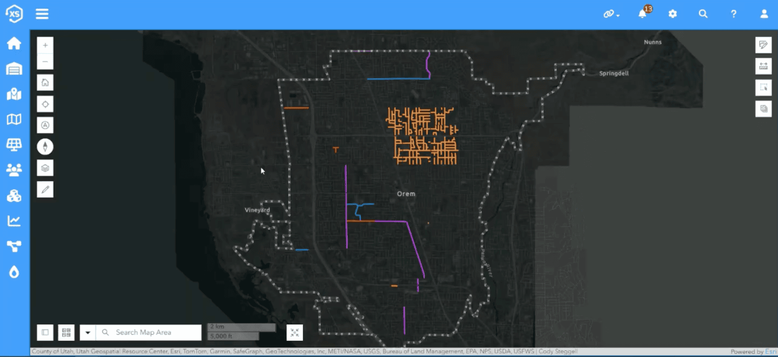
The integration of Elements and ArcGIS has also improved coordination between departments. “If water has a line break, they can trigger a patch request to streets,” Buxton says. “We’re using GIS to talk to each other.”
ArcGIS and Elements work seamlessly together to visualize this data on maps, color-coded by current condition or active projects. Inspectors can launch tasks directly from the map, log findings, and update the GIS in real time.
A Culture of Collaboration and Innovation
What ties these stories together is a shared philosophy: build GIS-based solutions that reflect real-world workflows. “Always make the electronic process mirror the real-life process,” says Roger Dunn, Orem GIS Administrator, “Not the other way around.”
That mindset has fostered a culture of GIS-centered innovation across Orem’s public works divisions. Whether it’s hydrant flushing, sewer inspections, or road resurfacing, teams are using Elements and ArcGIS to streamline operations, reduce redundancy, and make data-driven decisions.
“We’re not just building software,” emphasizes Dunn. “We’re building systems that help people make better decisions.”
Buxton agrees, “I think we have one of the best road inspection programs in the state”.
And in Orem, that’s just the beginning.
This story is part of an ongoing series highlighting how the City of Orem is using GIS and digital tools to transform public works. Stay tuned for more behind-the-scenes looks at the people, processes, and platforms driving smarter infrastructure and better service delivery.