
Better Maps
Pull up any parcel or section of land to easily create new and interact with historical documents and activities. A direct integration with Esri's modern ArcGIS platform offers the ultimate user experience.

Track anything
Process any type of application, document, or waiver with the most flexible solution on the market, complete with user-definable automations, forms, datasets and more.application, document, or waiver with the most flexible solution on the market, complete with user-definable automations, forms, datasets and more.

Easy online submittals
Collect any inbound application or form online with a custom branded portal. Automatically link applications and documents to parcels or other map-based assets for easy record management.


Process any document online
Work from anywhere
Access the entire application anywhere, using any device with internet access. Applicants can submit data from anywhere and internal staff can fully process any inbound application from anywhere.
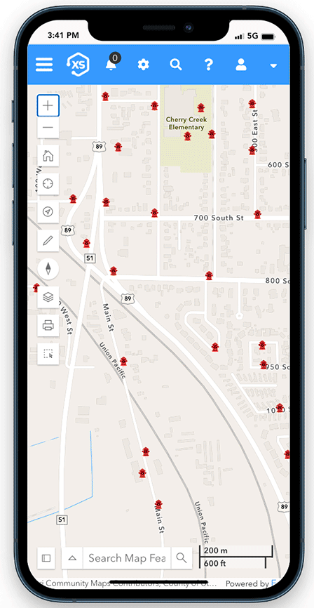
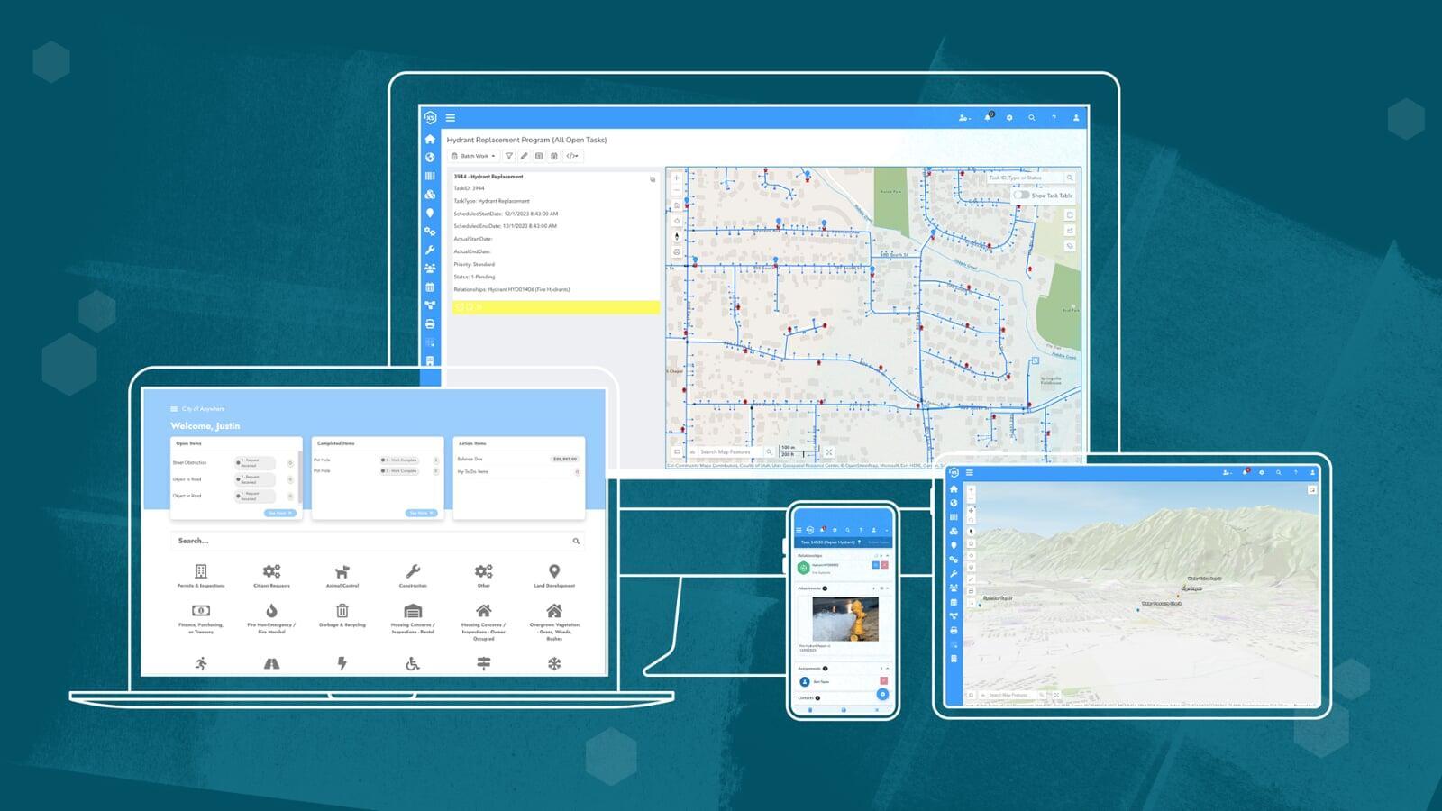
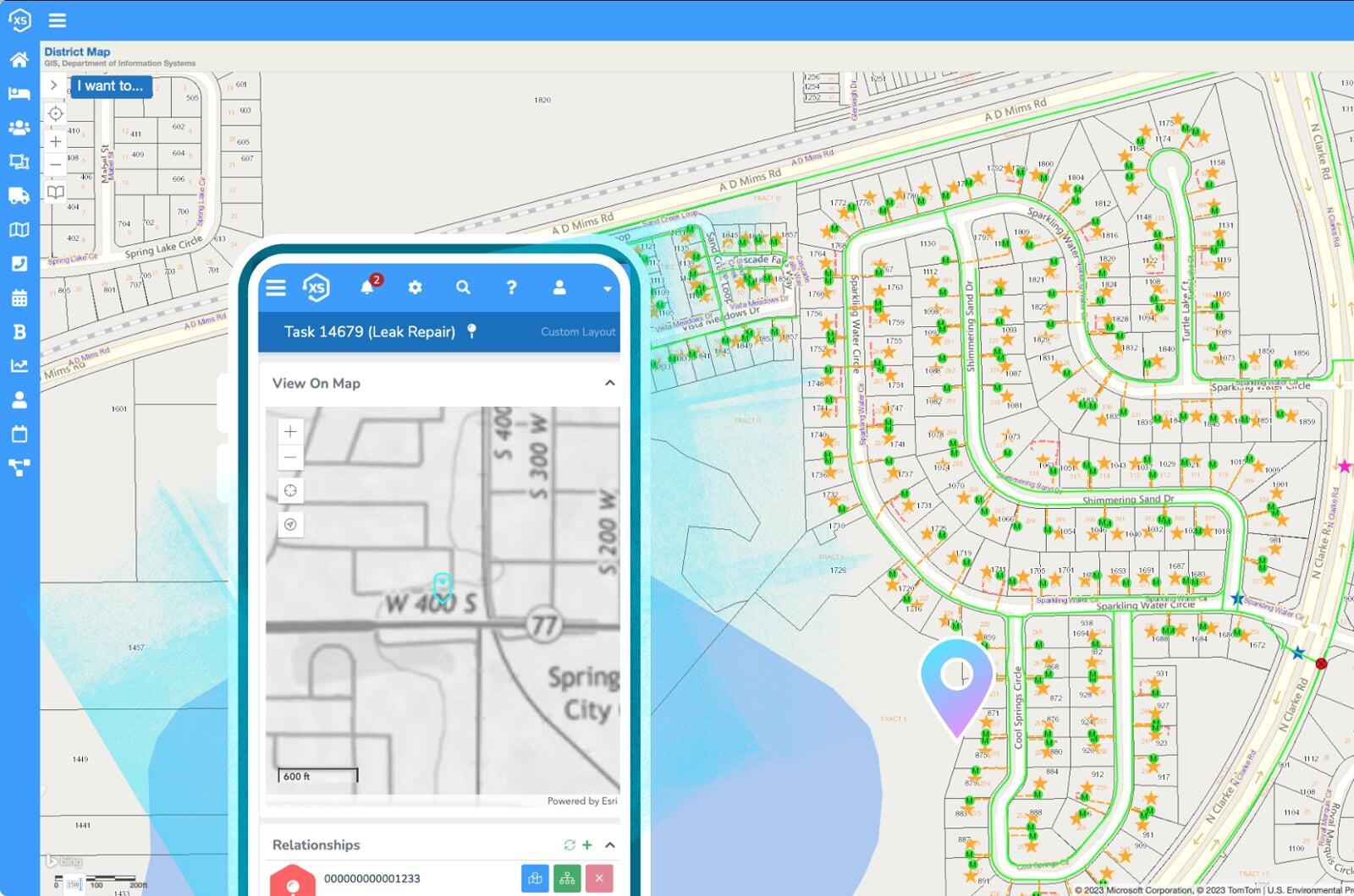
Find anything on the map, easy
All forms, applications, and documents are seamlessly integrated with Esri's ArcGIS system. Click on the map to see all historical and active documents for any area including applications, regulations, permits and much more.
One Platform. Clear Insights.
Better Results.
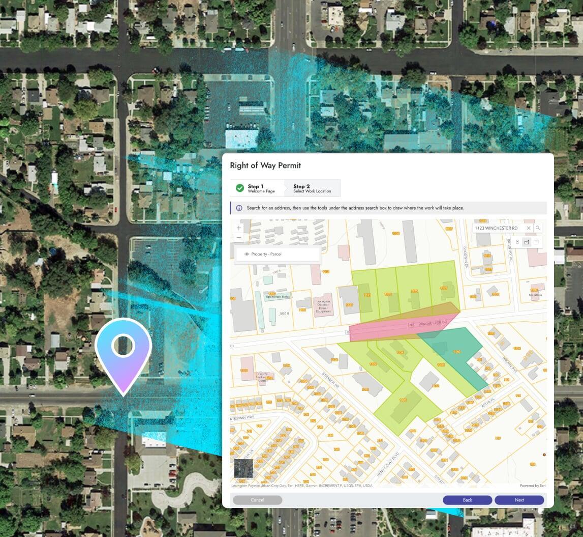
Zoning + subdividing
Process applications for zoning amendments, subdivision applications, conditional land use permits, tax classifications, and much more. Online, from anywhere, fully integrated with your ArcGIS maps for the best possible experience.

Approvals + fees
Configure unique statuses and approval processes for any type of application or document. Process fees and collect payments online to get your money faster.
Notifications
Keep applicants in the loop with automated notifications for status updates and more. Applicants can easily login to your custom branded portal at anytime to view status updates on previously submitted documents and interact with your business.
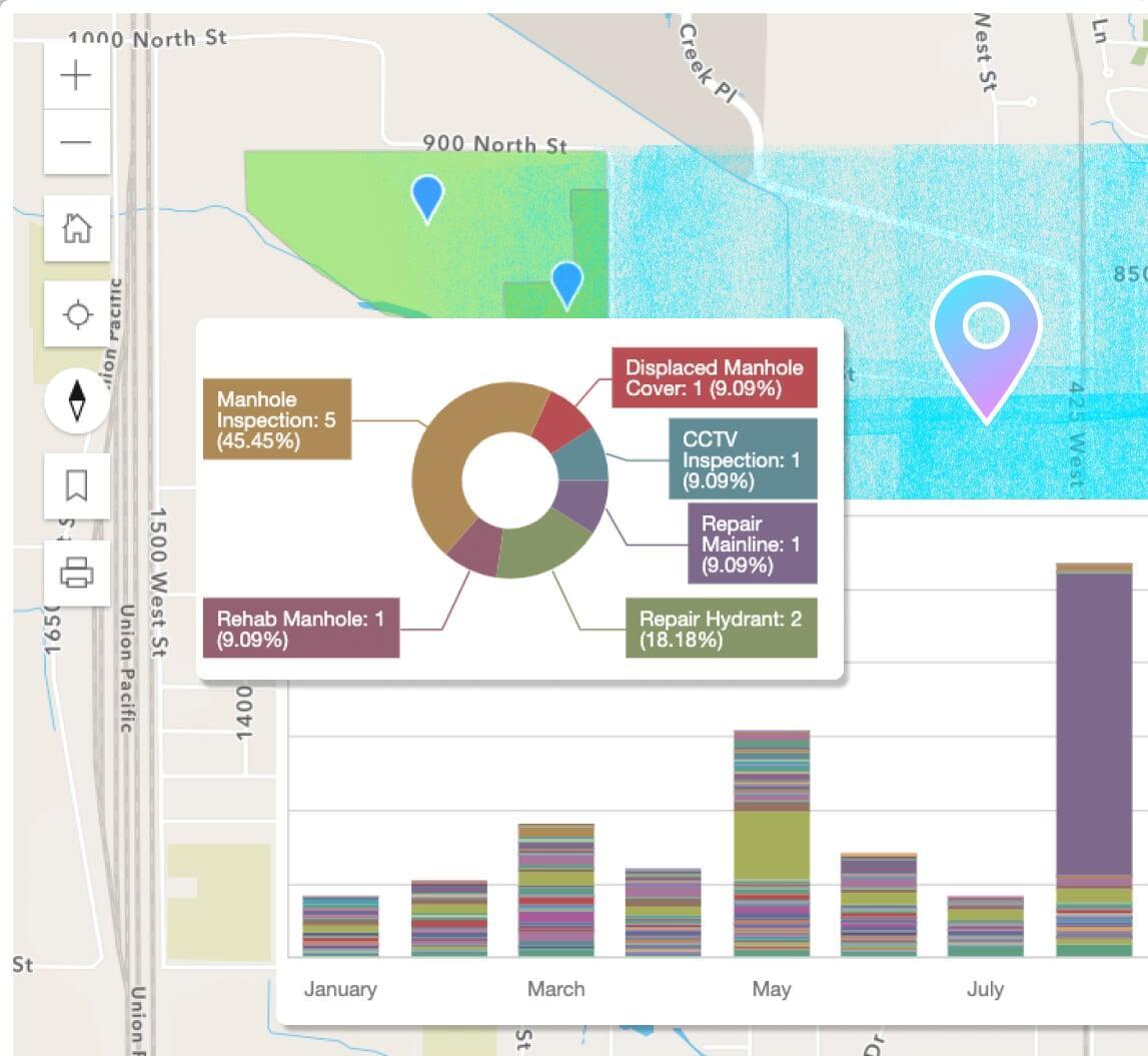
Reports, dashboards, & analytics
Use the included designs to create new or modify pre-built reports in a snap. Leverage the seamless ArcGIS integration for map-based analytics.
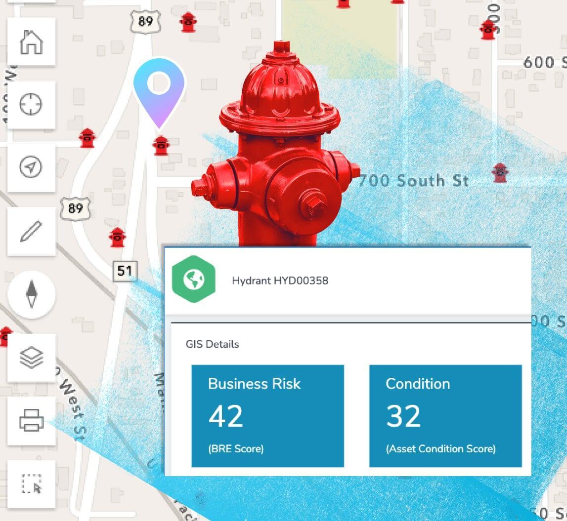
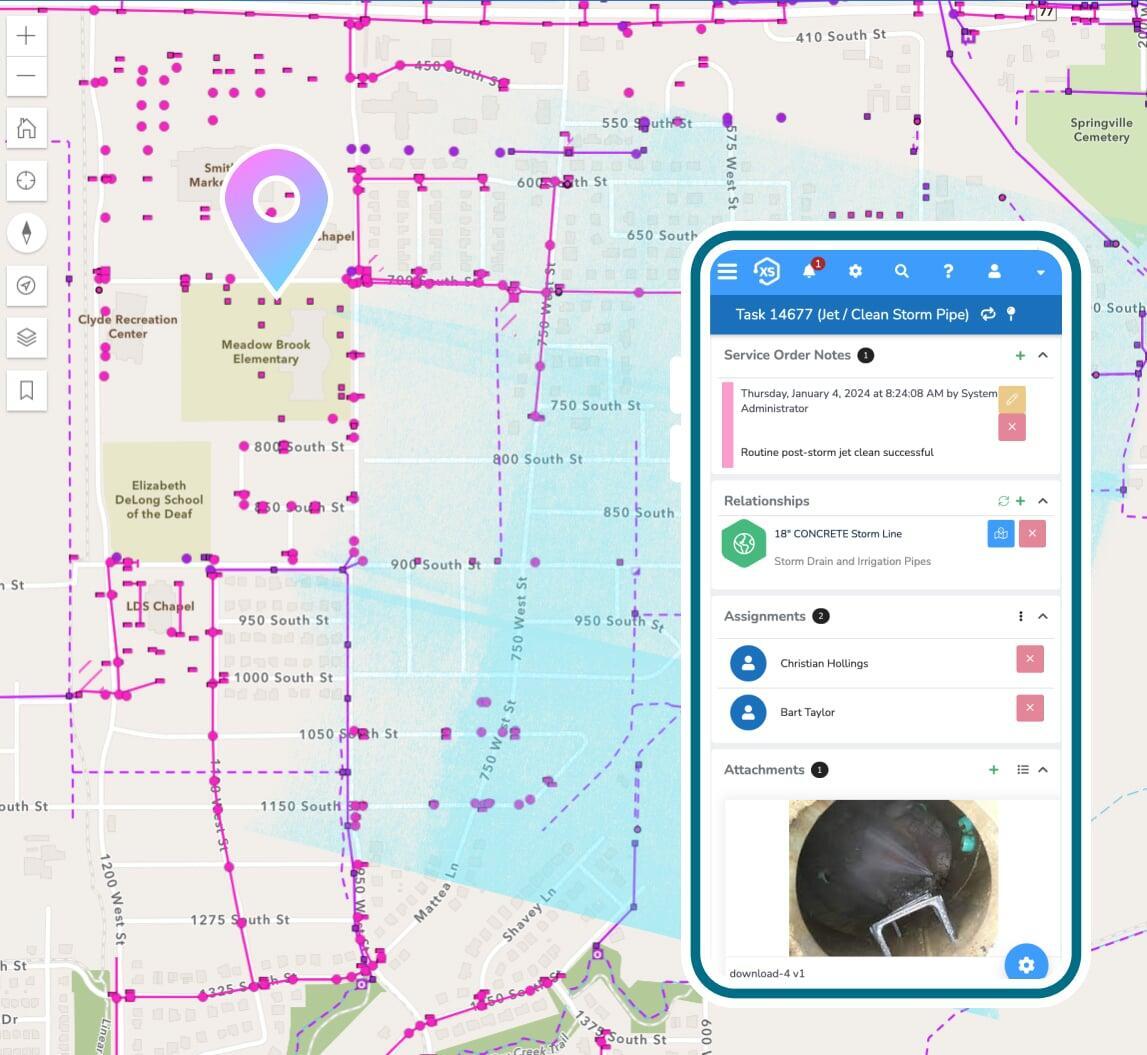
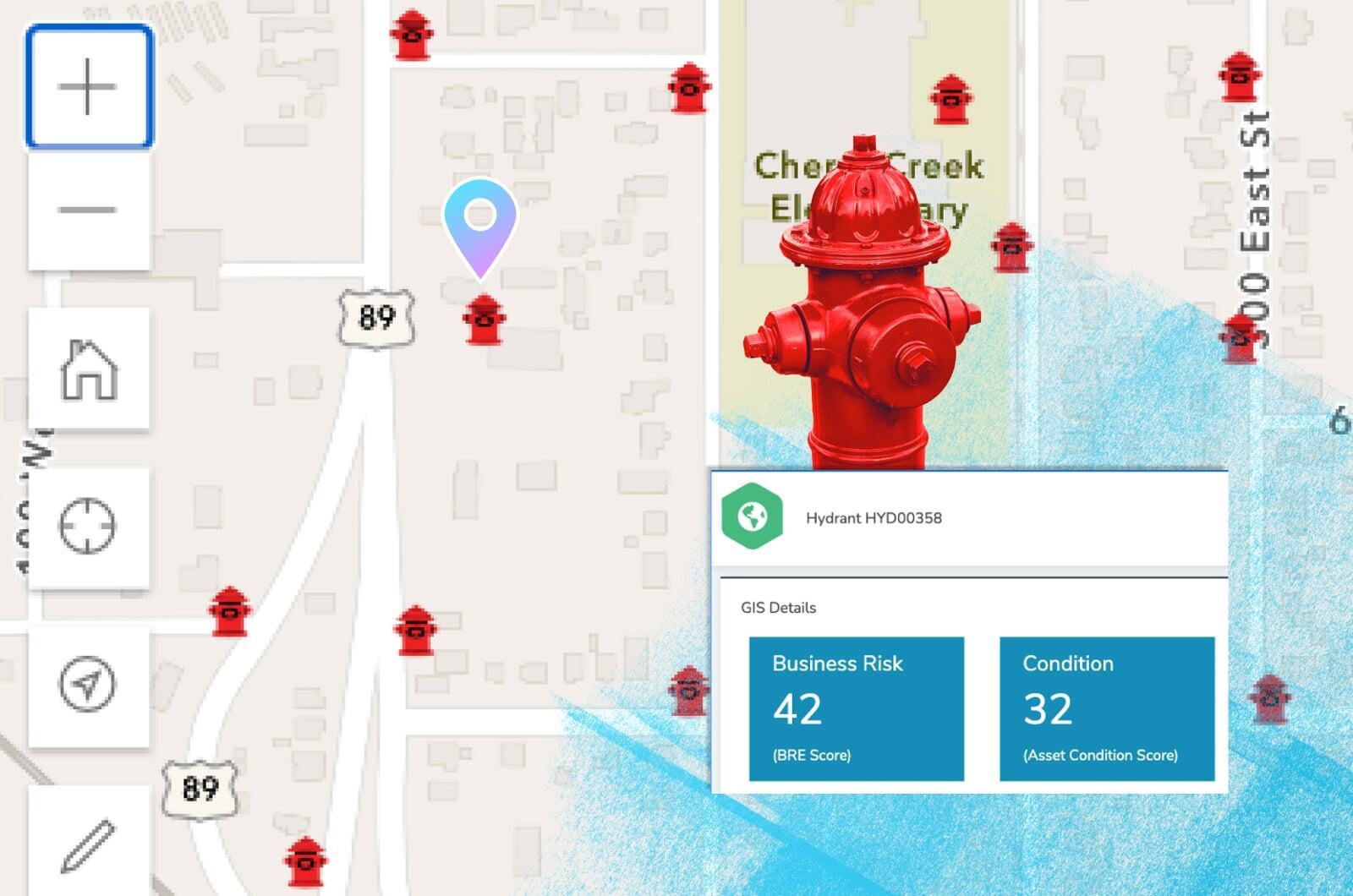
Business risk & asset scoring
Prioritize critical infrastructure with scoring and risk management factors including probability of failure, consequence of failure, and more.
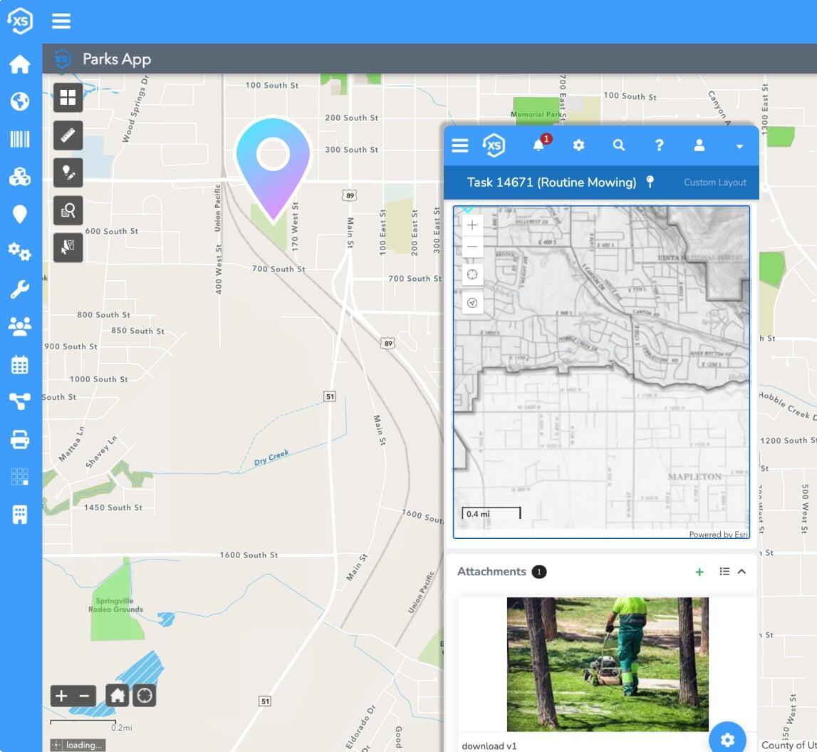
Maintenance: preventive & routine
Schedule maintenance based off of calendar dates, completed maintenance tasks, mileage, runtime hours, and other user-definable metrics.
Moving forward
Make the best recommendations
Provide data-driven, non-subjective plans to your council.
Create your ideal user experience
Easily tailor the interface with unlimited custom fields,
forms, and automations
Branded online portal
Applicants can submit any type of request or application through a portal that matches your unique branding, including your unique documents and terminology.
Coordinate your efforts
All departments use the same, unified interface to process documents and interact with applicants - providing a one-stop, seamless experience for citizens and a better coordination of efforts among city staff.
One interface, for everyone
No need to integrate multiple applications for different departments to share information. Everyone can use the same application and share relevant information for better customer service and fewer headaches.